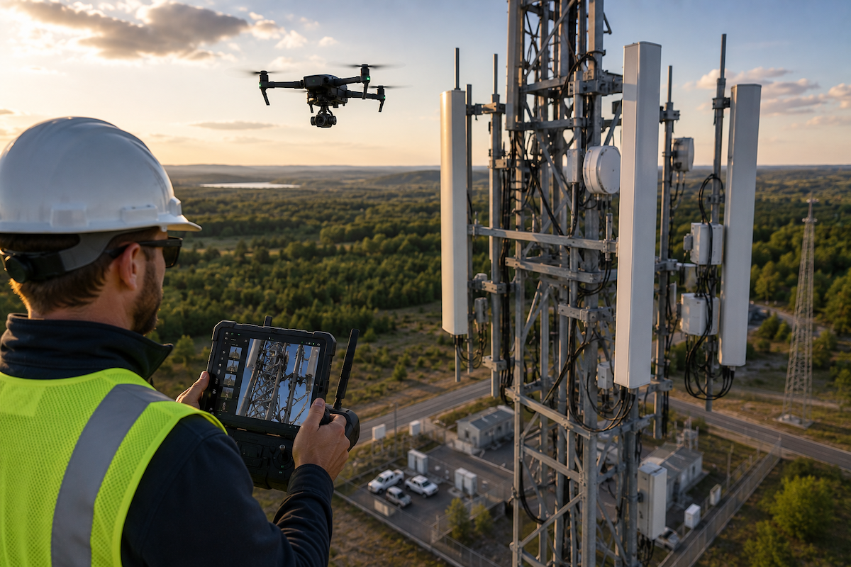
Climbing a 300-foot telecom tower is one of the most dangerous routine tasks in the industry, and it is also one of the slowest and most expensive ways to inspect one. A single climb means a certified tower hand, safety oversight, hours of work, and real risk every time someone leaves the ground.
Drones have changed what is possible, letting crews document antennas, mounts, and steel from the air without anyone climbing. But the flight is only the start. The software that turns those images into organized, prioritized findings is what actually cuts climbs and cost. Here is how that works.
Quick Summary
- Drone-based tower inspection lets carriers and tower operators document assets from the air, sharply reducing dangerous and costly climbs.
- The savings come from fewer climbs, faster data turnaround, and more frequent inspections at lower cost than manual methods.
- Inspection software is what makes it scale, by organizing imagery automatically and routing findings to crews fast.
- Utileyes auto-sorts images by asset using GPS metadata, leaving them inspection-ready the same day.
- Severity tagging and clean CSV integration carry findings straight into work order systems without manual rekeying.
- Utileyes moves from captured image to dispatch-ready work order in about 15 minutes, versus three to four weeks manually.
- Telecommunications is a named Utileyes solution area, covering towers, 5G, and fiber infrastructure.
The Real Cost of a Tower Climb
Every tower climb carries a price beyond the obvious labor. There is the certified climber's time, the ground support, the safety protocols, the scheduling, and the inherent risk that comes with working at height near live RF equipment.
Climbing also limits how often a tower gets inspected. Because each climb is costly and hazardous, operators tend to inspect only on a fixed schedule or when a problem is already suspected. That means developing issues, like corroded steel, loose mounts, or weather-damaged antennas, can go unseen between visits.
Drones break that constraint. A pilot on the ground can document an entire tower in a fraction of the time, with no climb required, which makes both safer and more frequent inspection realistic. The question then becomes what happens to all that imagery once it lands.
How Tower Inspection Software Cuts Climbs and Cost
Telecom tower inspection software cuts climbs and cost by turning drone imagery into organized, prioritized findings automatically, so operators inspect from the air, act on results quickly, and only send a climber up when a confirmed repair requires it. Instead of climbing to inspect, crews climb to fix, and only when the data says so.
Utileyes supports this through a connected workflow: mapping and flight assignment to plan tower coverage, auto-organized uploads to file imagery by asset, built-in QA to catch errors, severity tagging to prioritize findings, and CSV export into work order systems. The effect is that a tower flown in the morning can produce a ranked list of issues the same day, letting operators schedule a single targeted climb for repairs rather than an exploratory one to look for problems.
Where the Savings Actually Come From
The cost reduction in a drone tower program stacks up across several areas.
- Fewer climbs, since inspection happens from the air and climbers go up only for confirmed repairs.
- Lower labor and safety cost per inspection, with no need for a full climb crew to gather data.
- Faster turnaround, with findings reaching crews in about 15 minutes rather than weeks.
- More frequent inspections at lower marginal cost, catching issues before they escalate.
- Less manual processing, with Utileyes reporting 85% less processing time and 95% fewer organization errors.
- Reduced downtime risk, since earlier detection helps protect network uptime.
How a Drone Tower Inspection Workflow Runs
Moving from a planned flight to a targeted repair follows a clear sequence. Here is how it runs inside Utileyes.
- Map your towers. Upload existing GIS data or auto-generate asset points, then overlay sites onto a 3D topographic map.
- Assign the flight. Use the visual lasso tool to allocate towers to pilots and generate a preloaded flight plan synced with ArcGIS and ESRI.
- Fly and capture. Document antennas, mounts, steel, and connections from the air, with RGB and thermal imagery as needed.
- Auto-organize uploads. GPS metadata matches each image to its tower and the system sorts the set, ready to inspect the same day.
- Run built-in QA. Mismatched images are flagged instantly with one-click correction, so no one re-flies a site.
- Review and tag severity. Inspect images and tag findings by outage risk, safety hazard, or other priorities.
- Export and dispatch. Push clean CSV data into your work order system so a confirmed issue becomes a targeted climb assignment.
Beyond Towers: Fiber and 5G Infrastructure
Telecom networks are more than vertical steel, and a drone program built for towers extends naturally to the rest of the network. Fiber routes, distributed antenna systems, and 5G small-cell deployments all benefit from the same aerial documentation and organized analysis.
Utileyes lists telecommunications as a solution area covering towers, 5G, and fiber infrastructure, which means the same workflow, pilots, and software can support inspection across a carrier's footprint rather than just its tall assets. Keeping that work in one platform also keeps inspection history consistent and training light, with the company reporting 95% of users proficient within a day.
Making the Climb Count
The strongest argument for a drone tower inspection program is simple: every climb you avoid is a cost saved and a risk removed. By inspecting from the air and using software to turn imagery into prioritized findings, operators shift from climbing to look for problems to climbing only to fix confirmed ones. That single change cuts the most dangerous and expensive part of tower maintenance.
Utileyes makes the data side of that shift work, organizing tower imagery the moment it lands, ranking findings by severity, and pushing them into work order systems in about 15 minutes. For a carrier or tower operator, that speed turns aerial inspection from a data-collection exercise into a faster, safer maintenance cycle.
The clearest way to see the savings is to run your own sites through it. Schedule a demo, bring a tower you would otherwise climb to inspect, and measure how quickly a captured image becomes a targeted work order. Contact us today, info@utileyes.com.
Frequently Asked Questions
What is telecom tower inspection software?
It is a platform that manages drone-based inspection of telecom towers and related infrastructure, from flight planning and image capture through automatic organization, anomaly review, and crew dispatch. The goal is to reduce climbs by turning aerial imagery into prioritized, actionable findings.
How do drones reduce the number of tower climbs?
Drones let crews document a tower's antennas, mounts, and steel from the ground, so inspection no longer requires a climb. Climbers then go up only for confirmed repairs identified in the imagery, rather than to search for problems.
How much faster is drone tower inspection than climbing?
A pilot can document a full tower in a fraction of the time a climb takes, and with Utileyes, findings reach crews in about 15 minutes versus the three to four weeks a manual workflow can take. That speed also enables more frequent inspections.
Does tower inspection software work for 5G and fiber too?
Yes. Utileyes lists telecommunications as a solution area covering towers, 5G, and fiber infrastructure, so the same workflow extends across a network rather than just tall towers.
Does the software integrate with existing work order systems?
It does, which is what keeps findings from getting stranded. Utileyes syncs flight plans with ArcGIS and ESRI and exports clean CSV data directly into work order systems, turning a confirmed issue into a targeted climb assignment.