From Drone to Decision
in 15 Minutes, Not 3 Weeks

The only inspection platform built by utility veterans who understand that speed, simplicity, and control make the difference between preventing outages and explaining them.

USE CASES

One Platform. 
Every Inspection Need.

Our drone inspection software eliminates the chaos between data capture and actionable decisions. We've solved the #1 challenge utilities face: turning drone data into decisive action, fast.

Electric Utilities

Prevent Outages Before They Happen

Thermal hotspot detection
Vegetation encroachment monitoring
Storm damage assessment
Equipment condition tracking

Case Study: Regional co-op reduced outage minutes by 28% in first year

Telecommunications

Protect Public Assets Efficiently

Tower and antenna inspections
Fiber infrastructure monitoring
5G equipment thermal analysis
Right-of-way vegetation management

Result: 62% faster issue identification

Renewable Energy

Maximize Production, Minimize Downtime

Solar panel hotspot detection
Wind turbine blade analysis
Inverter thermal monitoring
Vegetation shadow assessment

Impact: 15% increase in energy output through proactive maintenance

Municipal Infrastructure

Protect Public Assets Efficiently

Streetlight inspections
Bridge and overpass monitoring
Water tower assessments
Public building thermal analysis

Savings: $240K annual vendor cost reduction

By the Numbers

15 minutes

From image capture to actionable report

95% Adoption

Most users are proficient in less than a day

50% Savings

Slash inspection costs compared to outsourced vendors

90% Faster

Turn weeks of manual reporting into hours

The Utileyes Difference

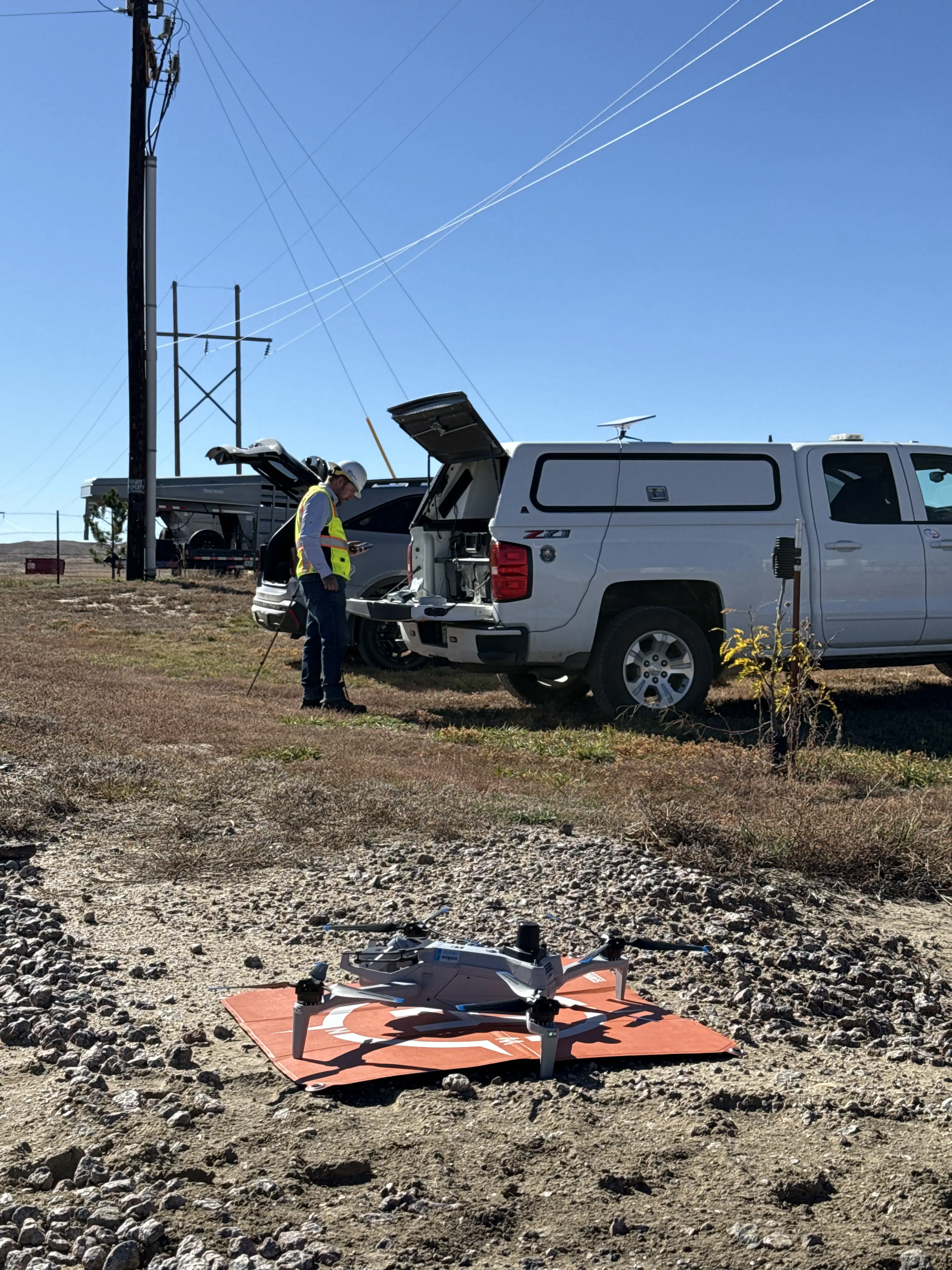
Speed That Saves Lives

The Stakes Are Real - During fire season, storm recovery, or emergency response, inspection speed isn't just about efficiency, it's about public safety and grid reliability.

The Old Way

stop
Manually creating flight maps
stop
Excel sheets for pilot assignments
stop
Paper forms for inspectioncriteria
stop
Hours of prep for one day offlying

The Utileyes Way

check
Auto-generated flight plans from your GIS data
check
Drag-and-drop pilot assignment by zone
check
Customizable digital inspection forms
check
5-minute setup for any mission

Labor Cost Elimination

Days of Work Reduced to Minutes - Massive ROI Impact

Intuitive User Experience

Faster Onboarding, Higher Adoption - Technology That Actually Gets Used

Experience That Counts

Built by Utility Veterans Who Understand Your Real Challenges

arrow_outward