A lineman in a bucket truck does not care which platform processed the inspection. He cares that the work order in his hand is accurate, prioritized, and arrived before the problem became an outage. That gap, between a photo sitting on a memory card and a crew showing up to fix something, is the real measure of inspection software. Most platforms talk about storing and organizing data.
The ones worth paying for close that gap. Below is a breakdown of the specific jobs your software has to handle in 2026, and how Utileyes was engineered to handle each.
Quick Summary
- Inspection software should carry a flight all the way from planning to crew dispatch, stripping out manual steps along the route.
- Images should sort themselves by asset using GPS metadata, landing inspection-ready the same day instead of days later.
- The platform should plug into ArcGIS, ESRI, and your work order system rather than trapping data inside itself.
- Utileyes closes the photo-to-dispatch loop in 15 minutes, against the three to four weeks a traditional workflow takes.
- Adoption should be quick. Utileyes reports 95% of users hitting proficiency inside a single day.
- Leadership should get live numbers on coverage, anomalies, and ROI, not a monthly slide deck.
- Utileyes was shaped by people who spent close to a decade inside utility drone operations, then built the tool they kept wishing for.
Why This Decision Outweighs the Hardware
Teams tend to obsess over which drone to buy. The drone matters far less than what happens after it lands. A top-tier aircraft feeding a clumsy software pipeline still leaves you with days of cleanup and findings that reach the field too late to prevent anything.
The broader shift in the industry backs this up. Utilities are pulling inspections in-house to win back speed and control, and the platform is what makes that move pay off. It decides whether two pilots can reasonably cover a whole region, whether an anomaly spotted on Monday reaches a crew before Friday, and whether any of that data ever shapes a maintenance budget.
Get the software right and the rest of the program loosens up. Get it wrong and you have simply traded a field bottleneck for a desk one.
The Core Jobs the Software Has to Own
Strip away the marketing and the mandate is straightforward: take a flight from the planning stage through to a dispatched crew, and remove human busywork at every handoff. A team should be able to map, fly, inspect, and act without bouncing between spreadsheets and disconnected tools.
Utileyes structures this as nine connected steps, covering asset mapping, flight assignment, preloaded flight plans, auto-organized uploads, built-in quality assurance, customizable inspections, severity tagging, CSV export and integration, and executive dashboards. None of these steps were added to pad a feature list. Each one targets a moment where utility teams historically lose time.
Job One: Make the Images Sort Themselves
The first and most commonly botched task is converting a memory card full of photos into structured, inspection-ready records.
On a lot of platforms, a pilot burns three to four days after a flight just wrangling files into the right folders before anyone can inspect a thing. Utileyes deletes that step from the process. As images upload, GPS metadata matches each one to its mapped asset and the system sorts everything automatically, leaving the set ready to review that same day. The company puts the gain at 85% less manual processing time and a 95% drop in organization errors. When something does land wrong, built-in QA catches it on the spot and offers a one-click reassignment, so nobody flies the route twice.
Job Two: Sort Findings by the Risk You Actually Carry
Spotting a cracked insulator means little if the right crew does not reach it at the right moment. Software has to let inspectors rank what they find against the hazards specific to your system.
Utileyes handles this with severity tagging that works during both standard image review and thermal scans. Issues get categorized by outage risk, safety hazard, or fire mitigation, and dispatch flows from those ratings rather than from a hunch. For any utility staring down wildfire liability, that turns a routine inspection into an active line of defense.
Job Three: Hand Off Cleanly to Your Existing Stack
Findings locked inside one application just shift the logjam downstream. The software needs to pass data into whatever your team already runs.
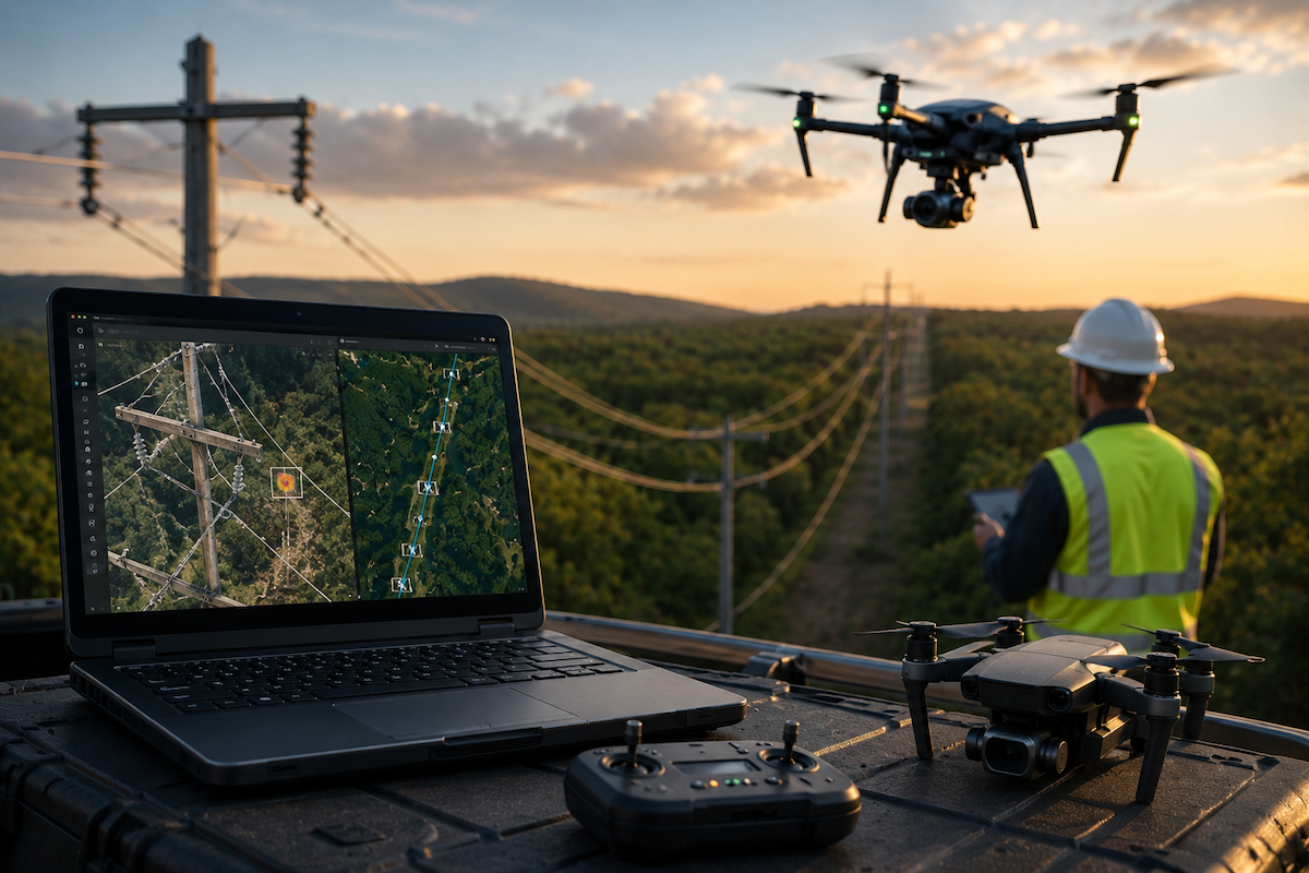
Utileyes builds for that handoff directly. Preloaded flight plans align with GIS data from ArcGIS and ESRI, and finished inspections export as clean CSV files that drop straight into a work order system. What you get is an unbroken line from the moment an image is captured to the moment a lineman receives the assignment, with no retyping in between.
Job Four: Crush the Lag Between Photo and Dispatch
If you want one number that tells you whether a platform is doing its job, measure how long it takes a captured image to become a work order a crew can act on. Everything upstream feeds that figure.
The spread between approaches is dramatic. A conventional workflow needs three to four weeks to go from flight to actionable work orders. Utileyes brings that down to roughly 15 minutes, depending on how complex the inspection is, a reduction near 90%. Speed here is not a vanity stat. It shortens storm recovery, tightens reliability, and gets fire hazards addressed while they are still hazards and not headlines.
Job Five: Stay Simple Enough to Survive Contact With the Field
A platform earns nothing if crews quietly abandon it. Features no one touches are just clutter with a price tag.
Plenty of systems arrive overbuilt and intimidating, which pushes field teams back toward their old habits. Utileyes went the other direction, aiming for simple, fast, flexible, and affordable. The proof shows up in adoption numbers: the company reports 95% of users reaching proficiency in under a day. That low barrier is exactly what lets a small in-house crew run a serious program.
Job Six: Show Leadership the Truth in Real Time
The last job is wiring field activity into the choices made by engineering, compliance, and the executive suite. Data that never climbs the org chart cannot improve a single decision.
Utileyes answers this with executive dashboards that track poles flown, inspections completed, anomaly severity, and efficiency metrics as they happen. Leaders slice the view by location, team, or window of time, which makes both day-to-day calls and ROI conversations far less of a guessing game.
A Checklist to Hold Any Platform Against
Run a prospective platform through these before you sign anything.
- Sorts images by asset via GPS metadata, inspection-ready the same day.
- Catches upload mismatches automatically and fixes them without a re-flight.
- Tags findings by outage risk, safety hazard, or fire mitigation.
- Syncs with ArcGIS and ESRI and exports clean CSV to your work order system.
- Turns a flight into a dispatch-ready work order in minutes, not weeks.
- Brings new users up to speed without a training marathon.
- Surfaces live coverage, anomaly, and ROI data for leadership.
Pressure-Testing the Claims Yourself
Anyone can promise these things in a slide deck, so make the platform prove them on your terms. Work through this during any evaluation.
- Load an actual day of field images and clock how fast they organize by asset.
- Slip in a deliberate mismatch and watch how the QA step responds.
- Tag a batch of findings by severity and check that the categories match your standards.
- Push the export into your own GIS or work order system to confirm the handoff holds.
- Time the complete run, from captured photo to a work order ready for dispatch.
- Hand the tool to someone untrained and see if they can finish an inspection.
The Bottom Line for Operations Leaders
When you boil it down, inspection software is worth its cost only if it does the unglamorous work of a real program: filing images the second they arrive, ranking findings by the risks that keep you up at night, talking to the systems you already operate, and collapsing the photo-to-dispatch wait from weeks into minutes. A platform that falls short on those simply moves your delay from one desk to another.
Utileyes was built to carry all six jobs inside one workflow, by a team that spent the better part of a decade watching utilities bleed time on manual photo sorting and decided to fix it. The same-day uploads, the ArcGIS and ESRI integration, the severity-driven dispatch, the 15-minute turnaround, all of it grew out of that firsthand frustration.
So put it to work against the checklist above and feed it your hardest inspection scenario. The fastest way to judge whether a platform does its job is to make it do yours, so book a demo and bring your messiest route. Contact us Today, info@utileyes.com.
Frequently Asked Questions
What should drone utility inspection software do?
Its job is to move a flight from planning through to crew dispatch while cutting out manual labor at each handoff. In practice that means auto-organizing images by asset, catching upload errors, ranking findings by severity, syncing with GIS and work order systems, and slashing the time between a photo and a dispatched crew.
How soon after a flight should images be ready to inspect?
Same day is the standard to hold out for. Utileyes matches images to assets through GPS metadata as they upload and sorts them automatically, which replaces the three-to-four-day manual scramble other platforms still require.
Does the software need to work with ArcGIS and ESRI?
It does, because integration is what keeps inspection data from dead-ending inside one tool. Utileyes aligns its flight plans with ArcGIS and ESRI and ships clean CSV exports straight into work order systems.
How fast can a utility get from drone photo to crew dispatch?
With Utileyes, a captured image becomes a dispatch-ready work order in about 15 minutes, complexity depending. Compare that to the three to four weeks a traditional inspection pipeline typically eats up.
Will field crews struggle to learn the software?
A well-designed tool should not put up that barrier. Overbuilt platforms tend to lose users, whereas a focused one gets adopted. Utileyes reports 95% of users proficient within a day, which is what makes it realistic for lean in-house teams to run.