MUNICIPAL INFRASTRUCTURE

Drone Inspection Software for Municipal Infrastructure That Protects Public Assets Efficiently

Prevents Outages Before They Happen

Utileyes gives cities, counties, and public works departments purpose-built drone inspection software to monitor streetlights, bridges, water towers, and public buildings. Bring inspections in-house, eliminate vendor delays, and cut public asset inspection costs by $240,000 or more in annual vendor spend.

$240K

in annual vendor cost reduction reported when municipalities transition from outsourced inspection contracts to in-house drone programs

Based on reported outcomes from public works programs that have transitioned away from outsourced inspections

Drone icon

15 minutes

from photo captured in the field to public works crew dispatched — with Utileyes

Competitor platforms can take up to 3 weeks from photo to actionable report. Utileyes gets you there in 15 minutes.

Data object icon

3–4 days

to organize field photos with leading competitor software. With Utileyes, that same step takes 5 minutes.

THE CHALLENGE

Why Public Works Departments Are Falling Behind on Asset Condition

With outsourced inspection programs, the gap from photo taken to crew dispatched is often measured in weeks. That delay is both a workflow inconvenience and a public safety risk. Utileyes was built to close that gap by automating the inspection workflow that public works teams actually run in the field.

3–4 days to organize field photos with leading competitor software. With Utileyes, the same task takes 5 minutes — photos are automatically sorted by GPS asset location the moment they are uploaded.

The Problem

Bridge and overpass inspections are expensive and infrequent

Manual bridge inspections require snooper trucks, lane closures, traffic control, and engineering contractors. The cost and disruption mean inspections happen on a fixed federal cycle rather than when condition actually warrants attention.

Streetlight outages are reported by residents, not detected by the city

Thousands of streetlights across a municipality fail invisibly until a constituent complaint comes in. Manual patrols are slow, and outage data is often weeks out of date.

Water towers and elevated assets carry high inspection risk

Climbing inspections on water towers, antenna masts, and elevated storage tanks expose workers to fall hazards and require specialized rigging. Many municipalities defer these inspections longer than they should because of the cost and risk.

Outsourced vendors leave you reactive

Third-party drone providers control your inspection schedule. Report delivery can take weeks — too slow for wildfire season, storm response, or proactive maintenance planning.
Utileyes drone inspection software logo mark
What Utileyes Does

Municipal Drone Inspection Software Built Around Four Critical Capabilities

Built with direct input from public works operators: designed to solve the problems your municipal team actually deals with day to day.
Utility power grid infrastructure and distribution network

Water Tower and Elevated Asset Assessments Without the Climb

Drone inspections eliminate the need to climb water towers, antenna masts, and elevated storage tanks for routine condition assessment. Capture coating condition, structural integrity, and hardware status from the air, and dispatch climbers only when a confirmed repair is needed.

  • Full exterior imagery of elevated structures
  • Reduces fall exposure and climbing-related risk
  • Documents coating condition and structural integrity
  • Photographic record for tank coating contractor work orders
Accuracy improvement target icon

Streetlight Inspections Across the Entire City Footprint

Aerial drone surveys cover every streetlight in a municipality faster than any ground patrol. Identify outages, lean, damaged poles, and missing hardware across thousands of fixtures in a single inspection cycle, with GPS-tagged evidence for every work order.

  • Citywide coverage in days instead of months
  • GPS-tagged photos for precise work order dispatch
  • Documentation of pole lean, damage, and hardware loss
  • Supports recurring inspections for condition trend tracking
Utility substation being inspected by drone-mounted camera
Drone flight icon

Bridge and Overpass Monitoring Without Lane Closures

Capture every angle of a bridge deck, underside, abutment, and supporting structure from the air. Inspectors review high-resolution imagery from the ground, flag spalling, cracking, and corrosion, and dispatch engineering review only when a confirmed concern is identified.

  • Full structural imagery of decks, undersides, and abutments
  • Reduces or eliminates lane closures during routine inspection
  • Documents spalling, cracking, and corrosion progression
  • Photographic record for federal and state compliance filings
Two inspection drones flying utility powerline route against open sky
Traditional inspection workflow path icon
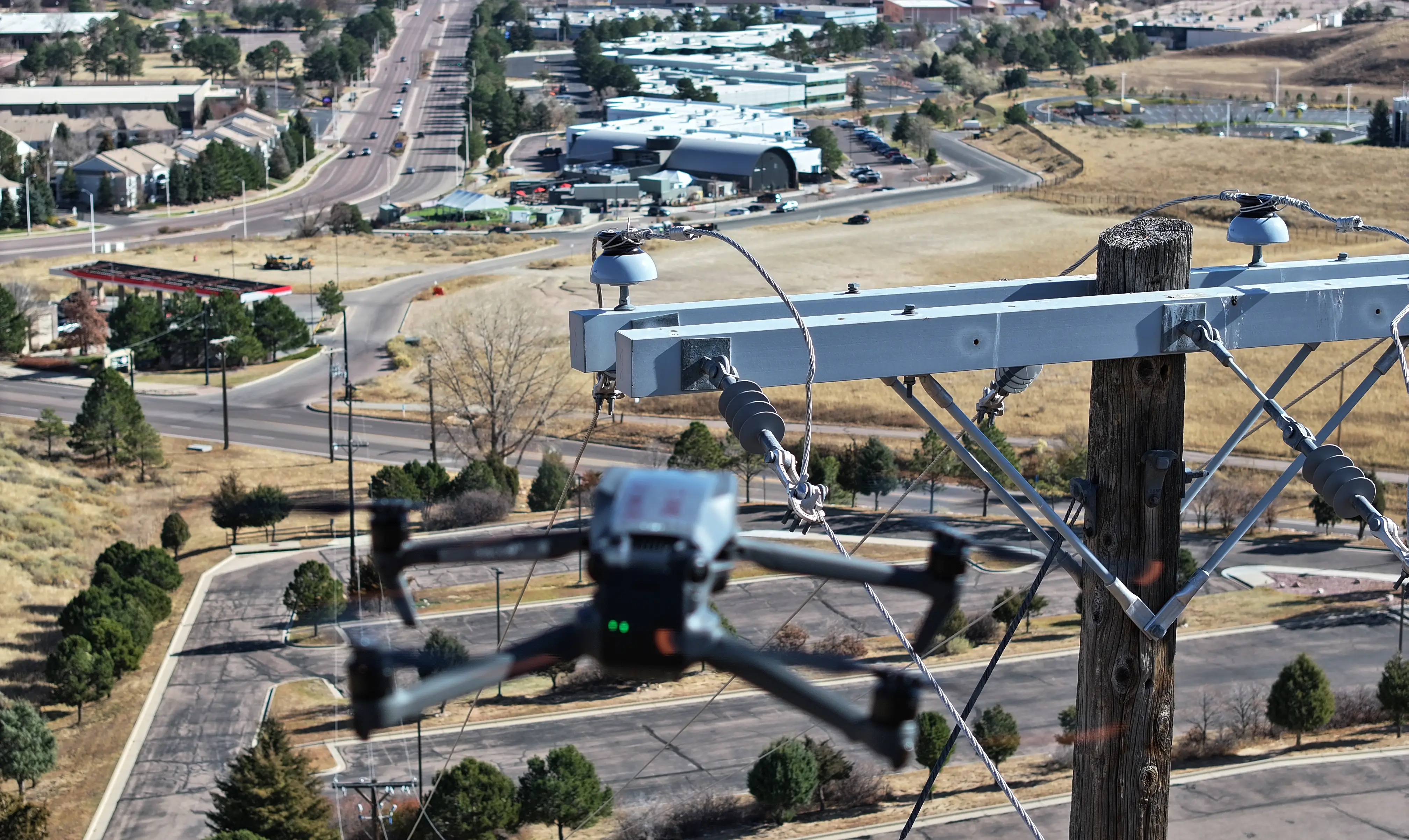
Close-up of inspection drone hovering near utility pole in urban area

Public Building Thermal Analysis for Roofs, Facades, and Electrical

Thermal drone inspections surface roof membrane leaks, masonry moisture intrusion, and overheating electrical service entrances across municipal buildings, fire stations, libraries, and schools. Schedule recurring thermal sweeps to catch issues before they become emergency repairs.

  • Thermal scans of roofs, facades, and electrical equipment
  • Severity ranking for prioritized capital planning
  • GPS-tagged anomalies for precise dispatch coordinates
  • Supports condition-based maintenance budgeting
Labor reduction engineering icon
The Utileyes Difference

How Utileyes Works: Photo to Dispatch in 15 Minutes

Most inspection platforms still require significant manual work between the flight and the work order. Utileyes automates the steps that slow everything else down: photo organization, asset matching, and report generation. Your team focuses on the inspection itself.

Step 1
Map and Assign

Upload a KML or CSV file, or auto-generate your route from flight data. Assign bridges, streetlight routes, and building footprints to pilots on the map.

Step 2
Fly and Capture

Pilots execute their flights and capture thermal and RGB imagery. GPS metadata is embedded in every photo at capture.

Step 3
Auto-Organize

Photos upload and sort automatically by asset and GPS location. No manual folder organization required.

Step 4
Inspect and Tag

Inspectors review imagery, tag anomalies, and rank issues by severity using customizable inspection forms.

Step 5
Report and Dispatch

Reports export to CSV or sync with your asset management or work order system. Crews dispatched to exact GPS coordinates.

Step 1
Map and Assign

Upload a KML or CSV file, or auto-generate your route from flight data. Assign bridges, streetlight routes, and building footprints to pilots on the map.

Step 2
Fly and Capture

Pilots execute their flights and capture thermal and RGB imagery. GPS metadata is embedded in every photo at capture.

Step 3
Auto-Organize

Photos upload and sort automatically by asset and GPS location. No manual folder organization required.

Step 4
Inspect and Tag

Inspectors review imagery, tag anomalies, and rank issues by severity using customizable inspection forms.

Step 5
Report and Dispatch

Reports export to CSV or sync with your asset management or work order system. Crews dispatched to exact GPS coordinates.

$240k

in annual vendor cost reduction documented in year one

Signal disconnected icon

3.1 X

return on investment through reduced truck rolls and avoided outages

Traditional inspection workflow path icon

Less than 30

days from program kickoff to first live inspection flights

Drone icon

15 minutes

photo to dispatch, versus weeks with their previous vendor

PROGRAM OUTCOME

Mid-Sized Municipality

How One City Cut $240K in Annual Vendor Spend After Bringing Drone Inspections In-House

A mid-sized municipal public works department transitioned away from outsourced inspection contracts and built an in-house drone inspection program. Starting with a single district and two FAA Part 107-certified pilots from existing staff, they had a functional inspection program running in under 30 days from program launch. By shifting to a consistent in-house inspection cadence — including recurring streetlight patrols, bridge condition surveys, and thermal sweeps of public buildings — the city was able to eliminate the bulk of their third-party inspection contract spend and respond to asset condition issues weeks faster than under their previous vendor model. After 12 months, the city documented $240,000 in reduced vendor spend and a 3.1x return on investment through avoided emergency repairs and faster maintenance response.

Outcome based on documented results from in-house drone inspection programs. Individual outcomes vary based on asset inventory size, baseline vendor spend, and inspection frequency.
Utileyes
Capability
Outsourced Vendor Programs
Enterprise Platforms
Photo to dispatch time
15 Minutes
1-3 weeks for final report
Varies-days to weeks
Auto photo organization by GPS
Check icon
(Vendor handles internally)
Varies by platform
Built for in-house utility teams
Check icon
(External service model)
(Enterprise IT focused)
Thermal hotspot detection support
Check icon
Depends on vendor capability
Varies by platform
Operational in under 30 days
Check icon
N/A
(Implementation takes months)
Simple enough for linemen to use directly
Check icon
N/A
(Typically requires dedicated admin)
On-demand deployment post-storm or red flag
Check icon
Subject to vender scheduling
Software only, depends on team
arrow_outward