VEGETATION MANAGEMENT

LiDAR Vegetation Management Software That Finds Encroachment Before It Becomes an Outage

Prevents Outages Before They Happen

Utileyes lets electric utilities upload LiDAR data alongside drone imagery to identify, prioritize, and manage vegetation risk across every circuit, then move from finding to field action in as little as 15 minutes.

50%+

inspection cost reduction utilities report after moving from outsourced vendors to in-house drone programs

Based on reported outcomes from utilities that have transitioned to in-house programs

Drone icon

15 minutes

from photo captured in the field to crew dispatched with Utileyes

Other platforms can take up to 3 weeks from photo to actionable report.

Data object icon

3–4 days

to organize field photos with leading competitor software. With Utileyes, that same step takes 5 minutes.

THE CHALLENGE

Why Utility Vegetation Management Programs Fall Behind

Vegetation is the one hazard on your system that grows every day. Most programs still rely on fixed trim cycles, periodic ground patrols, and LiDAR deliverables that sit in a separate system from inspection data. By the time a clearance issue reaches a work order, the risk has often already grown. Utileyes brings LiDAR data and inspection imagery into one workflow so vegetation teams can see where risk is concentrated and act on it first.

LiDAR shows you where vegetation is. Utileyes connects it to the assets, imagery, and work orders your crews need to do something about it.

The Problem

LiDAR data sits disconnected from operations

LiDAR surveys produce massive datasets, but without a way to tie them to specific assets and work orders, the findings rarely reach the field quickly.

‍

Fixed trim cycles miss fast-growing hazards

Calendar-based schedules treat every corridor the same. High-risk spans can encroach well before the next scheduled trim.

‍

Prioritization is guesswork

Without consistent severity data across your system, vegetation budgets get spread evenly instead of directed at the corridors most likely to cause an outage or ignition.

‍

Contractor work is hard to verify

Confirming that trimming was completed to spec often requires another site visit. Missing documentation creates gaps during wildfire mitigation plan reviews.
Utileyes drone inspection software logo mark
What Utileyes Does

Vegetation Management Software Built Around Four Critical Capabilities

Built with direct input from utility operators, designed to turn vegetation data into prioritized field action.

Utility power grid infrastructure and distribution network

Vegetation Risk Prioritization by Severity

‍

Rank vegetation risks by severity so your team and contractors work the highest-risk corridors first. Direct trimming budgets based on actual conditions rather than fixed calendar cycles.

‍

  • Severity ranking for every vegetation finding
  • Prioritize high fire-risk and outage-prone circuits
  • Condition-based data to support trim cycle planning
  • Customizable inspection forms and scoring
Accuracy improvement target icon

LiDAR Data Upload and Processing for Utility Corridors

‍

Upload LiDAR data directly into Utileyes and bring it into the same platform your team already uses for drone inspections. Vegetation data, asset locations, and inspection imagery live together instead of across separate tools and vendor deliverables.

‍

  • Upload LiDAR datasets directly into the platform
  • LiDAR and drone imagery in a single workflow
  • Vegetation findings tied to asset and GPS location
  • No separate system required to review results
Utility substation being inspected by drone-mounted camera
Drone flight icon

Vegetation Encroachment Detection Along Rights-of-Way

‍

Identify where vegetation is encroaching on conductors and structures across your system. Pair LiDAR findings with RGB and thermal imagery to confirm conditions and document what your crews will find on site.

‍

  • Encroachment identified across circuits and corridors
  • Imagery confirmation alongside LiDAR findings
  • Repeatable surveys for trend monitoring over time
  • Photo evidence attached to every finding
Two inspection drones flying utility powerline route against open sky
Traditional inspection workflow path icon
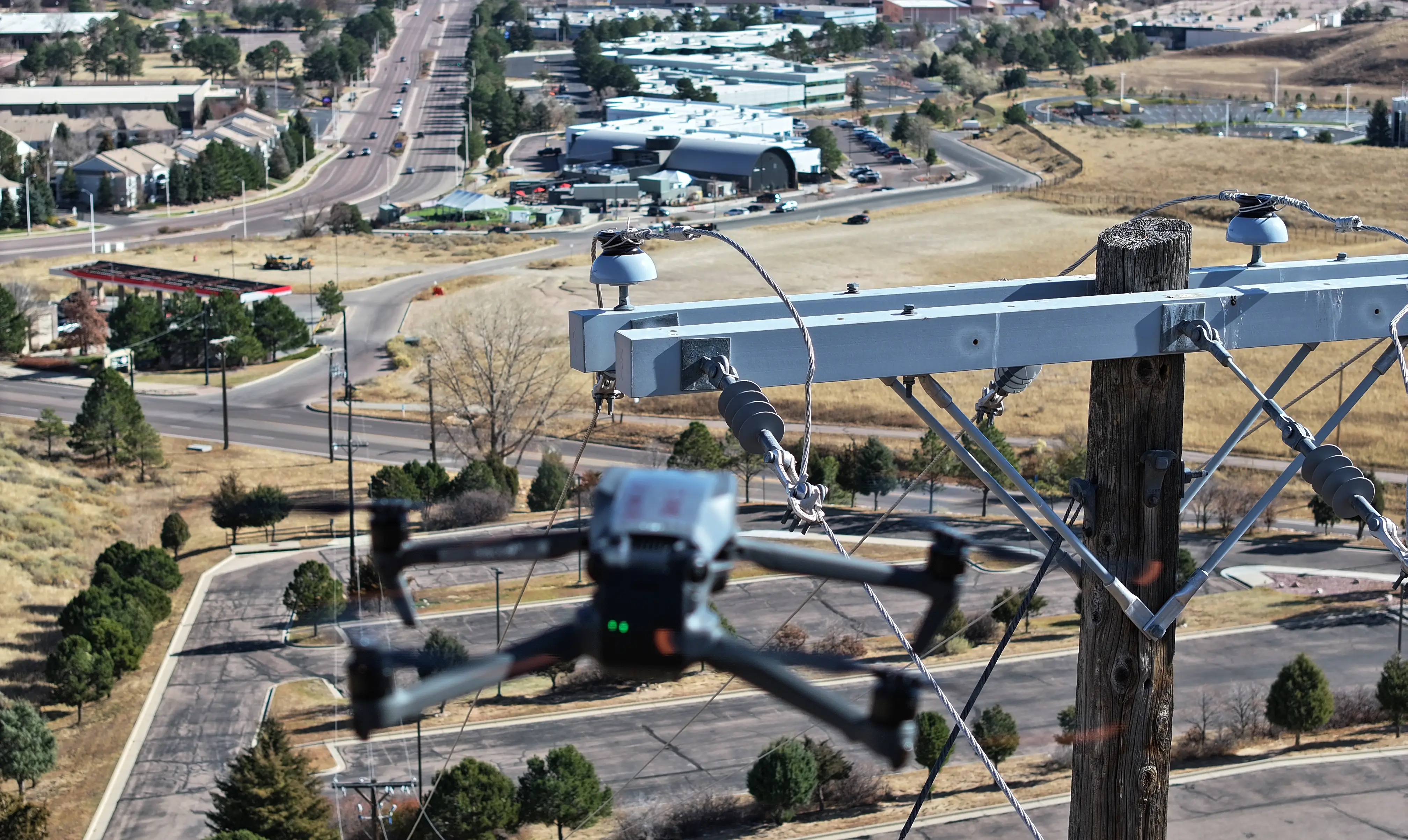
Close-up of inspection drone hovering near utility pole in urban area

Vegetation Work Order Management and Wildfire Mitigation Documentation

‍

Move vegetation findings into work orders with GPS coordinates and photo documentation attached. Verify contractor work with follow-up surveys and keep a time-stamped record for wildfire mitigation plan reporting.

‍

  • Export to GIS, EAM, and work order management systems
  • GPS coordinates for precise contractor dispatch
  • Before-and-after documentation to verify completed work
  • Records that support wildfire mitigation plan reviews
Labor reduction engineering icon
The Utileyes Difference

How Utileyes Works: From LiDAR Upload to Crew Dispatch

Most vegetation programs still require manual work to connect survey data to the assets and work orders that need it. Utileyes automates the steps between the data and the field so your team spends its time acting on risk, not organizing files.

Step 1
Upload and Map

Upload LiDAR data along with a KML or CSV asset file. Utileyes maps your corridors and assets in one view.

Step 2
Fly and Capture

Pilots capture RGB and thermal imagery on targeted corridors. GPS metadata is embedded in every photo at capture.

Step 3
Process and Organize

LiDAR data is processed and imagery is sorted automatically by asset and GPS location.

Step 4
Identify and Prioritize

Vegetation risks are flagged and ranked by severity so the highest-risk spans rise to the top.

Step 5
Report and Dispatch

Reports export to CSV or sync with your work order system. Crews and contractors are dispatched to exact GPS coordinates.

Step 1
Upload and Map

Upload LiDAR data along with a KML or CSV asset file. Utileyes maps your corridors and assets in one view.

Step 2
Fly and Capture

Pilots capture RGB and thermal imagery on targeted corridors. GPS metadata is embedded in every photo at capture.

Step 3
Process and Organize

LiDAR data is processed and imagery is sorted automatically by asset and GPS location.

Step 4
Identify and Prioritize

Vegetation risks are flagged and ranked by severity so the highest-risk spans rise to the top.

Step 5
Report and Dispatch

Reports export to CSV or sync with your work order system. Crews and contractors are dispatched to exact GPS coordinates.

62%

faster response to vegetation threats in a single season

Signal disconnected icon

3.1 X

return on investment through reduced truck rolls and avoided outages

Traditional inspection workflow path icon

Less than 30

days from program kickoff to first live inspection flights

Drone icon

15 minutes

photo to dispatch, versus weeks with their previous vendor

PROGRAM OUTCOME

Western Electric Utility

How One Utility Cut Vegetation Response Time by 62% on Its Highest Fire-Risk Circuits

A western electric utility launched a drone inspection program targeting its top 5% most fire-prone circuits. Combining thermal imagery and high-resolution RGB photos with inspection software that ranked findings by severity, the team scanned more than 10,000 poles in a single season. They identified and prioritized 273 potential ignition risks, reduced response time to vegetation threats by 62%, and avoided an estimated $1.4M in potential fire damage.

Outcome based on real utility program data. Details represent documented results; individual outcomes vary based on system size, inspection frequency, and baseline conditions.
Utileyes
Capability
Outsourced Vendor Programs
Enterprise Platforms
Photo to dispatch time
15 Minutes
1-3 weeks for final report
Varies-days to weeks
Auto photo organization by GPS
Check icon
(Vendor handles internally)
Varies by platform
Built for in-house utility teams
Check icon
(External service model)
(Enterprise IT focused)
Thermal hotspot detection support
Check icon
Depends on vendor capability
Varies by platform
Operational in under 30 days
Check icon
N/A
(Implementation takes months)
Simple enough for linemen to use directly
Check icon
N/A
(Typically requires dedicated admin)
On-demand deployment post-storm or red flag
Check icon
Subject to vender scheduling
Software only, depends on team
arrow_outward