How do you know a substation inspection actually covers everything that matters? Many utility teams fly a substation, capture a batch of photos, and move on to the next site without a clear answer to that question. A substation inspection checklist closes that gap. It defines which components need visual coverage, which need thermal imagery, and how the resulting photos should be reviewed and acted on. This guide covers what a thorough substation drone inspection should capture, how to build a checklist your crews can repeat consistently, and how inspection software turns the photos into prioritized, dispatch-ready findings instead of a folder nobody opens.
Quick Summary
What a Substation Drone Inspection Should Cover
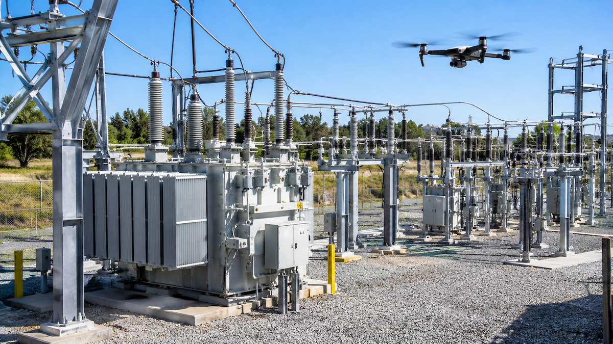
A substation packs more equipment into a small footprint than almost any other utility asset, which is exactly why an unstructured inspection misses things. A complete checklist should name every major component rather than leaving coverage to the pilot's judgment on the day. At minimum, that list includes:
Each of these items should be assigned a capture type (visual, thermal, or both) and an inspection interval, so the checklist tells a crew exactly what to fly and how often, rather than leaving it to recall.
Visual vs. Thermal Imagery: What Each One Catches
Visual and thermal imagery answer different questions, and a checklist that only specifies one misses the other half of the picture.
What Visual Imagery Catches
High-resolution visual photos are best for physical and structural issues: cracked insulators, corrosion, rust on structural steel, loose or missing hardware, vegetation encroaching on the fence line, and visible damage after a storm.
What Thermal Imagery Catches
Thermal imagery is built for problems that show up as heat before they show up as damage: overheating connections, imbalanced phases, overloaded breakers, and failing insulators that are starting to arc. These are the defects most likely to cause an unplanned outage if they go unnoticed, which is why thermal coverage belongs on every substation checklist rather than being treated as optional.
Building a Substation Inspection Checklist
A usable checklist maps each component to a capture type and a review priority. A simplified version looks like this:
ComponentCapture TypeWhat to FlagPower transformersVisual + ThermalOil leaks, bushing damage, abnormal heat signaturesCircuit breakersThermalHot connections, uneven phase temperaturesBus connectionsThermalLoose or corroded joints running hotInsulatorsVisual + ThermalCracking, tracking, localized heatingStructural steelVisualCorrosion, grounding damage, missing hardwareControl houseVisualRoof damage, exterior conduit issues
Once this kind of checklist exists, every crew flies the same substation the same way, which makes year-over-year comparisons meaningful instead of inconsistent.
Why Photo Organization Is the Hardest Part of a Substation Inspection
A single substation visit can produce hundreds of images across visual and thermal cameras. The flying is usually the fast part. Sorting those photos by asset, matching them to the correct GPS location, and figuring out which ones show something worth flagging is where manual processes slow down. Done by hand, that photo-sorting step alone commonly takes three to four days per site. Inspection software built for utility workflows can compress that same sorting step to about 15 minutes by automatically matching photos to assets and flagging likely anomalies for review, cutting data organization errors by about 95% along the way.
Turning Flagged Substation Defects Into Work Orders
A flagged thermal anomaly is only useful if it reaches the people who schedule repairs. Instead of a reviewer manually re-typing findings into a separate work order system, dispatch-ready software can convert a flagged defect directly into a work order tied to the correct asset. Across the full cycle, from photo capture to a work order showing up in the queue, this kind of workflow can take about 15 minutes instead of the three to four weeks a fully manual process often takes, while cutting manual processing time by roughly 85%.
Integrating Substation Inspection Data With GIS and Asset Management
Substation inspection data is more useful when it lives alongside the rest of a utility's operational data instead of in a separate silo. Software that integrates with ArcGIS and Esri lets flagged defects show up on the same maps crews already use for asset management, while exports into existing work order and asset management systems mean inspection results don't require a second, parallel record-keeping process.
Featured Snippet: Substation Inspection Checklist at a Glance
A substation inspection checklist should specify, for every major component, whether it requires visual imagery, thermal imagery, or both, along with how often it needs to be reviewed. The goal is to replace pilot judgment on inspection day with a documented standard that every crew follows the same way, and to route the photos that come back into software that can sort, flag, and convert them into work orders without someone manually reviewing every image.
Steps to Build a Substation Inspection Checklist
What Belongs on Every Substation Checklist
Conclusion
A substation inspection is only as good as the checklist behind it. Naming every component, assigning it a capture type, and setting a review interval turns an inspection from a judgment call into a repeatable process. The next step is making sure the photos that come back from that process don't sit unreviewed. Software that automatically sorts images by asset, flags likely defects, and converts them into work orders removes the slowest part of the workflow, and most crews are comfortable running it within a day. Utileyes was founded by utility and drone industry veterans, including a co-founder who also co-founded one of the top drone service providers in the country, and it was built around exactly this kind of checklist-driven, dispatch-ready workflow.
Frequently Asked Questions
How often should substations be inspected by drone?
Inspection frequency depends on the substation's age, load, and criticality, but most utilities build a recurring schedule into their checklist rather than inspecting on an ad hoc basis. Higher-risk components, like heavily loaded transformers and breakers, are typically reviewed more often than structural elements like fencing.
What's the difference between a visual and thermal substation inspection?
Visual imagery catches physical and structural problems, such as cracked insulators, corrosion, and visible damage. Thermal imagery catches problems that show up as heat before they cause visible failure, such as overheating connections and overloaded breakers. A complete checklist uses both.
Can drone inspection software integrate with GIS systems like ArcGIS?
Yes. Utileyes integrates with ArcGIS and Esri, so flagged substation defects and other inspection results can appear on the same maps and asset records utility teams already use, rather than living in a separate system.
How long does it take a crew to learn a new substation inspection software platform?
Based on Utileyes user data, about 95% of users become proficient within a day of hands-on use, since the software is built to automate the sorting and flagging steps rather than requiring crews to learn a complex manual workflow.
What happens after a defect is flagged during a substation inspection?
A flagged defect should be reviewed and, once confirmed, converted into a work order tied to the correct asset. Software that automates this step can take a substation inspection from photo capture to a work order in about 15 minutes, compared with three to four weeks for a fully manual process.
See It in Action
Substation inspections produce too much data to manage by hand. Schedule a demo or contact our team to see how Utileyes turns substation photo and thermal data into prioritized, dispatch-ready work orders.