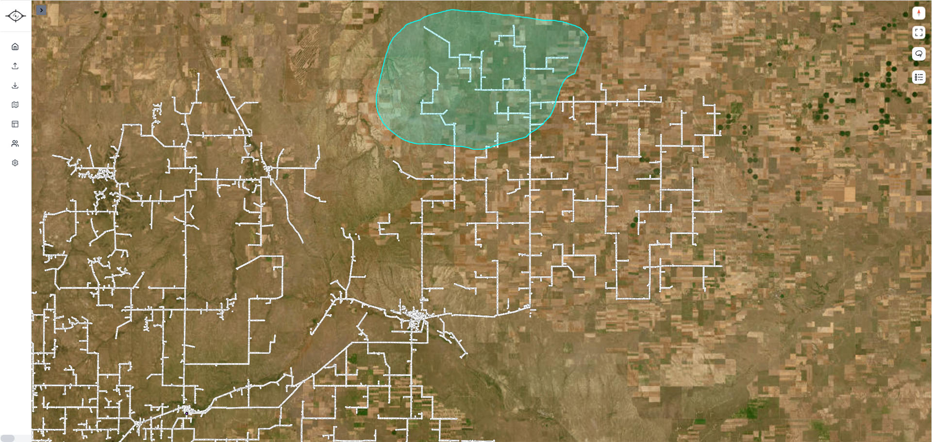
Assign pilots in seconds with our simple visual lasso tool.

Coordinating pilots for drone powerline inspections has traditionally been a logistical nightmare. Utilities often rely on spreadsheets, emails, or phone calls to divide inspection routes—a process that is slow, error-prone, and nearly impossible to scale. The result? Missed poles, duplicate flights, and unnecessary downtime. Even many existing drone utility inspectionplatforms fail here, offering little more than basic scheduling tools that don’t solve the real problem.
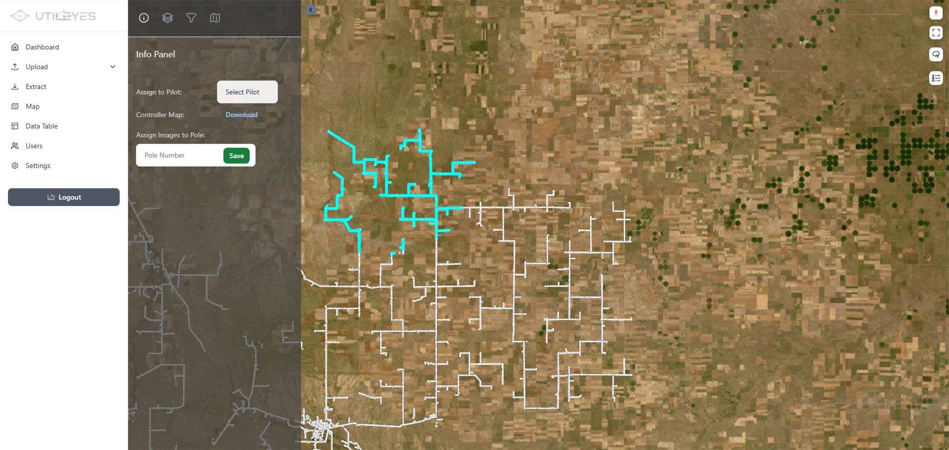
That’s why Utileyes built a visual Flight Assignment tool that changes the way utilities manage inspection workflows. With our intuitive lasso feature, managers simply drag across the map to select groups of poles, towers, or spans, then assign them instantly to specific UAV pilots. No more manual cross-checking, no more double coverage—just a clear, visual workflow that ensures every asset is covered without overlap.
This approach is especially powerful for large UAV power line inspection programs where thousands of assets must be inspected across wide service territories. Instead of spending hours dividing work manually, assignments can be completed in minutes. For utilities running their own in-house drone inspection programs, that time savings means more flights, faster data capture, and fewer administrative bottlenecks.
But efficiency is only part of the story. With visual assignments, utilities also gain confidence and accountability. Every pilot knows exactly which poles or spans they are responsible for, reducing confusion and improving safety in the field. For teams focused on fire mitigation and vegetation management, this ensures no gaps in coverage where risks could otherwise be missed.
In short, Utileyes turns a traditionally painful, manual process into a streamlined, scalable solution. Flight Assignment gives your utility drone inspection program the clarity and efficiency it needs—so your crews can spend less time planning and more time flying.