Turn scattered spreadsheets into a unified 3D inspection map.

Managing utility assets at scale has always been a challenge. Traditionally, utilities rely on outdated spreadsheets, paper maps, or disconnected GIS systems to keep track of their poles, towers, and substations. These manual methods introduce errors, slow down operations, and make it nearly impossible to ensure that every inspection flight is aligned with the latest asset data. Even many existing drone utility inspection tools only offer partial solutions, forcing teams to manually merge files or juggle incompatible formats.
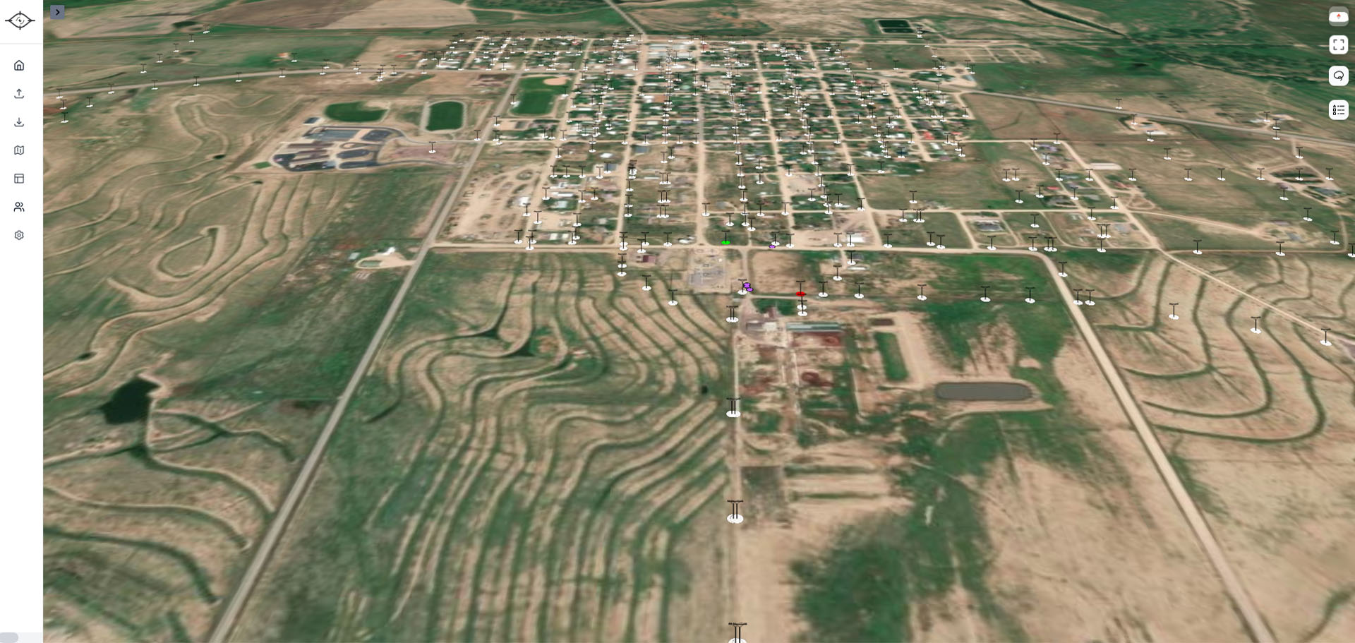
Our Smart Asset Mapping feature eliminates these inefficiencies. With just a few clicks, you can upload KML or CSV files containing your existing asset data. Already have your infrastructure mapped in another system? No problem—we support direct uploads, instantly translating your data into an interactive inspection map. Even better, when assets aren’t mapped yet, you can generate new points in-flight as your power line inspection drone captures imagery. This flexibility means no more guesswork, no more wasted flights, and no reliance on siloed data sources.
What makes Utileyes unique is our custom mapping platform. Utility companies can view asset points overlaid onto a 3D topographic map, providing unmatched insight before ever stepping into the field. This visualization helps teams preplan where and how to access poles, towers, or spans—highlighting terrain challenges, vegetation density, and right-of-way restrictions. Instead of discovering obstacles once boots are on the ground, managers and pilots can anticipate them in advance, improving safety and reducing costly delays. For utilities tackling fire mitigation or managing rugged territories, this capability is a game-changer.
The result is a single, unified asset map that acts as the backbone for your entire UAV power line inspection workflow. By standardizing your asset data and making it both visual and topographic, we help you eliminate redundant flights, reduce missed poles, and ensure complete coverage. Instead of spending hours preparing flight plans or reconciling mismatched files, your team can focus on what matters most—inspecting assets and solving real operational challenges.
In short, Smart Asset Mapping transforms a painful, manual step into a streamlined process. It’s the foundation that ensures every other stage in your drone power line inspection workflow runs smoothly, accurately, and at scale.