

Vegetation is one of the most persistent threats to grid reliability. Trees and brush grow year-round, conditions change between inspection cycles, and the consequences of missing an encroachment range from a localized outage to a catastrophic wildfire. Traditional ground-based and helicopter patrols have kept the lights on for decades, but they were never designed for the pace, scale, and precision that modern vegetation management now demands.
Drone-based ROW monitoring is changing how utilities identify, prioritize, and respond to vegetation threats. For utilities building in-house drone programs, it also represents one of the highest-value applications of that investment from day one.
Why Vegetation Encroachment Is a Persistent Operations Problem
The two primary failure modes that vegetation management programs are designed to prevent are grow-ins, where trees or shrubs grow upward into clearance zones, and fall-ins, where trees outside or inside the ROW fall into conductors. Both can cause sustained outages and, in fire-prone regions, can trigger ignitions with serious consequences.
NERC Reliability Standard FAC-003 establishes mandatory vegetation management requirements for transmission owners, requiring utilities to prevent encroachment into minimum vegetation clearance distances and mandating annual inspection of applicable lines. Violations carry significant penalties. Since 2020, FAC-003 violations have carried the highest average penalty per violation of any non-CIP NERC reliability standard, with fines that can reach into the hundreds of thousands of dollars per violation. The most common root cause cited in recent enforcement actions is an ineffectively designed vegetation management plan, including overreliance on visual assessment, inspections conducted at too great a distance, and failure to account for fast-growing species or difficult terrain.
Distribution lines are not subject to FAC-003, but they face the same physical risks. Vegetation contact is a leading cause of distribution outages, and in high fire-threat districts, state regulators increasingly hold utilities to vegetation clearance standards that mirror or exceed NERC requirements.
The Limits of Traditional ROW Inspection Methods
Ground patrols and walking surveys are slow, inconsistent, and often incomplete for terrain that involves dense canopy, steep slopes, or remote corridors. Helicopter patrols cover more ground but are expensive, and the data they produce is often limited to visual observation without precise measurement or GPS-tagged documentation.
The core problem with both approaches is that they rely on human judgment at the point of observation, without a structured way to compare current conditions against previous surveys, measure actual clearance distances, or generate the kind of geolocated records that compliance programs require.
What Drone-Based ROW Monitoring Provides
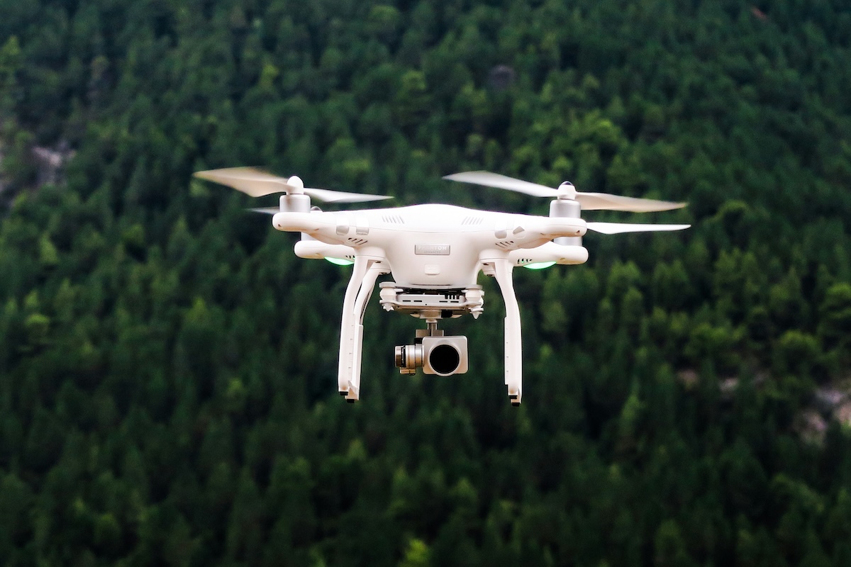
Drones address the gaps in traditional vegetation inspection by combining high-resolution imagery, GPS metadata, and optionally thermal or LiDAR payloads, into a repeatable, documented workflow.
For standard ROW monitoring, RGB drone imagery captures the visual condition of the corridor: canopy height relative to conductors, visible encroachment from the sides, and tree health indicators like dead limbs or species that are likely to fail. Every image is GPS-tagged, tied to a specific location along the ROW, and ready to be organized by asset when uploaded to an inspection platform.
For more precise clearance analysis, LiDAR-equipped drones can measure actual distances between conductor and vegetation with high accuracy, identifying areas where clearances are being approached before a grow-in reaches a violation threshold. LiDAR point cloud data can also detect vegetation that is not yet visible in standard imagery because it is below the canopy, but growing toward the line.
Thermal sensors add another layer, helping identify tree stress or hazard trees that may be candidates for fall-in risk independent of clearance distance.
From Observation to Prioritized Work Orders
The value of drone-based vegetation monitoring is not just in the data captured. It is in what happens with that data. Raw imagery of a 50-mile corridor helps no one if it sits unorganized on a hard drive.
This is where inspection software becomes the operational engine of the program. Utileyes Inspections connects the ROW flight directly to structured inspection outcomes. Images are automatically organized by GPS location and asset, reviewed and tagged by inspectors, ranked by severity, and exported to work order systems or GIS layers. Vegetation findings can be categorized by type: grow-in encroachment, fall-in risk, dead or diseased trees, or species-specific concerns relevant to your region.
The result is a trimming prioritization list that is tied to actual field conditions, not a fixed rotation schedule or an inspector's memory from a windshield survey conducted six months ago.
Supporting Compliance Documentation
One of the practical advantages of drone-based vegetation monitoring that often goes underappreciated is compliance documentation. FAC-003 requires utilities to demonstrate that they managed vegetation to prevent encroachment, and enforcement experience shows that documentation gaps can be as damaging as the violations themselves.
Drone inspections produce GPS-tagged, timestamped image records of corridor conditions across every inspection cycle. That evidence base supports annual plan compliance, demonstrates active monitoring between cycles, and provides documentation that can stand up to regulatory review. For utilities in fire-threat districts that face additional state-level vegetation management obligations, the same records can be shared with regulators or used in wildfire mitigation plan submissions.
Integrating Vegetation Monitoring Into a Broader Inspection Program
One of the practical advantages of an in-house drone program is that vegetation monitoring does not need to be a separate effort from asset inspection. The same flight that captures conductor and hardware condition along a feeder can also document the state of the ROW on either side. Pilots cover the corridor, and inspectors review the imagery for both asset anomalies and vegetation concerns simultaneously.
Utileyes Inspections supports this combined workflow. Customizable inspection forms allow teams to tag and categorize vegetation findings alongside hardware defects, so the same image review session produces both a vegetation work list and an anomaly report for the engineering team. The data exports to the same GIS and work order destinations, keeping vegetation management and grid maintenance on a single coordinated track.
High-Fire-Threat Districts Require More Frequent Monitoring
For utilities operating in wildfire-prone regions, annual inspection cycles are not enough. Vegetation grows seasonally, drought conditions change fall-in risk rapidly, and red flag weather can increase the consequence of any unaddressed encroachment overnight.
In-house drone programs make more frequent monitoring practical. A certified pilot can fly a high-risk circuit in a morning, upload images before noon, and have a prioritized vegetation work list in the hands of field crews the same day. That responsiveness is not achievable with an outsourced inspection model that requires scheduling weeks in advance.
Utileyes Inspections was built with this use case in mind. The platform supports rapid flight-to-findings cycles, and anomalies flagged for fire mitigation can be categorized and prioritized separately from routine maintenance findings, so the most urgent vegetation threats reach field crews first.
What to Track as Your Program Matures
As drone-based vegetation monitoring becomes a routine part of your inspection cycle, the data you collect over multiple inspection rounds becomes increasingly valuable. Comparing imagery from successive flights reveals growth rates along specific circuits, identifies persistent problem areas that may warrant a change in trimming strategy, and tracks whether contractor work actually addressed the findings that were documented.
Over time, this creates a data-driven foundation for moving from calendar-based trimming rotations to condition-based vegetation management: focusing resources where the risk is highest rather than spreading them evenly across a territory on a fixed schedule.
Closing the Gap Between Flight and Field Action
Vegetation management has always been a documentation, prioritization, and coordination problem as much as a field operations problem. Drones solve the data capture challenge. Inspection software like Utileyes Inspections solves the data-to-action challenge. And an in-house program brings both together under operational control, rather than depending on vendors and contractors to set the pace.
The utilities that get the most out of drone-based ROW monitoring are the ones that treat it as an integrated part of their operations, not a standalone technology project. When vegetation findings feed directly into work orders, compliance records, and trimming schedules, the program pays for itself in prevented outages and avoided penalties.
Frequently Asked Questions
Does FAC-003 apply to distribution lines as well as transmission?
FAC-003 applies specifically to applicable transmission lines, not distribution lines. However, distribution vegetation management is subject to state utility commission requirements and internal reliability standards, which vary by jurisdiction. In high fire-threat districts, state rules for distribution vegetation clearances can be equally stringent.
How often should utilities fly ROW inspections with drones?
This depends on circuit risk level, vegetation growth rates in your region, and regulatory requirements. Transmission lines in fire-threat districts may warrant monthly or quarterly flights during high-risk seasons. Lower-risk distribution circuits may be appropriate for semi-annual inspections. An in-house program makes more frequent monitoring practical because it eliminates the scheduling delays and costs of outsourced flights.
Can a standard drone inspection detect fall-in risk from trees outside the ROW?
Standard RGB imagery can identify visually apparent hazard trees near the ROW boundary, such as dead standing timber or leaning trees. LiDAR provides more precise canopy and height data that allows utilities to assess trees adjacent to the ROW more systematically. For utilities in high-risk areas, pairing RGB with LiDAR gives the most complete picture of both grow-in and fall-in exposure.
How does drone vegetation data support NERC compliance documentation?
Drone inspections produce GPS-tagged, timestamped image records that document corridor conditions at the time of the inspection. This creates an auditable evidence base demonstrating active monitoring and vegetation management activity, which is directly relevant to the evidence requirements under FAC-003.
Can vegetation findings from drone flights feed into our existing work order system?
Yes, if your inspection platform exports in compatible formats. Utileyes Inspections exports vegetation findings to CSV and integrates with ArcGIS, ESRI, and work order platforms, so trimming crews receive geolocated, prioritized work lists directly from the inspection workflow without manual re-entry.


