Picking drone utility inspection software comes down to a handful of factors that genuinely move the needle, and a lot of features that sound impressive but change very little day to day. The criteria below cut through the noise. Each one reflects what separates a platform that shortens the path from captured photo to dispatched crew from one that simply stores your images in a tidier folder.
Read on to learn the eight criteria that matter most when choosing drone utility inspection software in 2026, why each one matters, and how Utileyes was purpose-built to meet them.
Quick Summary
- The eight criteria that matter most are workflow automation, GIS and work order integration, thermal and RGB support, ease of use, photo-to-dispatch speed, data portability, scalability, and reporting quality.
- Workflow automation is the single biggest differentiator, since it removes the days of manual photo sorting that slow most programs.
- Utileyes auto-sorts images by asset using GPS metadata, making them ready to inspect the same day.
- Utileyes moves utilities from photo to crew dispatch in 15 minutes, compared with the three to four weeks common in traditional workflows.
- Integration with existing systems like ArcGIS and ESRI matters more than raw feature count, and Utileyes exports clean CSV data directly into those systems.
- Utileyes was built by utility and drone operations veterans, for utilities, rather than adapted from a generic drone platform.
- Always test each criterion with your own field data rather than trusting a feature list.
What to Look For Before You Compare Platforms
Before weighing any single feature, get clear on what you are actually inspecting and how your current process works. The right software depends on your assets, your team size, and where time is lost today.
Document your existing workflow from flight to repair dispatch, and mark every step where data stalls or gets re-entered by hand. Those bottlenecks are what the software needs to solve. A platform that excels at something you do not struggle with adds little value, while one that erases your biggest delay can reshape your entire cost structure.
With that baseline in place, the eight criteria below give you a structured way to compare options against real operational needs.

The 8 Criteria That Matter
Use these eight criteria as your evaluation framework. They are ordered by how much impact each tends to have on a working program.
- Workflow automation. How much manual work the software removes between image capture and inspection.
- GIS and work order integration. Whether inspection data flows cleanly into the systems your team already uses.
- Thermal and RGB support. Whether the platform handles severity-based review across image and thermal scans.
- Ease of use. How quickly a new pilot or inspector becomes productive without heavy training.
- Photo-to-dispatch speed. How fast a finding turns into a dispatch-ready work order.
- Data portability. Whether you can export records in standard formats and avoid lock-in.
- Scalability. Whether a lean team can cover large territories without adding headcount.
- Reporting quality. Whether the software gives leadership real-time visibility into coverage, anomalies, and ROI.
Criterion 1: Workflow Automation
Automation is the criterion that separates platforms more than any other. Feature lists look similar across vendors, but the amount of manual labor a system removes varies enormously.
The clearest test is photo organization. With many platforms, pilots spend three to four days organizing photos after a flight before inspection can even begin. Utileyes eliminates that step entirely. Images are matched to mapped assets using GPS metadata and auto-sorted on upload, so they are ready to inspect the same day. The platform reports an 85% reduction in manual processing time and a 95% reduction in data organization errors as a result.
Multiply that difference across thousands of poles and several inspection cycles, and automation becomes the largest driver of program cost and speed.
Criterion 2: GIS and Work Order Integration
Inspection data that lives in a silo creates a new bottleneck even when the inspection itself was fast. Integration capability often matters more than the number of features a platform advertises.
Utileyes is built to connect with the tools utilities already use. Preloaded flight plans sync with GIS data including ArcGIS and ESRI, and inspection results export as clean CSV files ready for instant upload into work order systems. The goal is a continuous chain from image capture to a work order your linemen can act on, with no manual re-entry along the way.
Criterion 3: Thermal and RGB Support
Many of the most valuable inspection findings come down to severity, not just a clear photo. A platform needs to let inspectors flag what matters and route it by risk.
Utileyes supports severity tagging during both image review and thermal scans, letting teams categorize issues by outage risk, safety hazard, or fire mitigation. Crews are then dispatched based on real priorities rather than guesswork, which is especially important for utilities managing wildfire exposure.
Criterion 4: Ease of Use
Ease of use is not a soft factor. It directly determines adoption, training cost, and whether a small internal team can actually run the program.
Other platforms tend to be overengineered and complicated, with deep feature menus that go underused because crews find them hard to learn. Utileyes was built to be simple, fast, flexible, and affordable. The result shows in adoption: the company reports that 95% of users become proficient in less than a day. When you evaluate this criterion, watch how long it takes someone new to complete a full inspection cycle unassisted.
Criterion 5: Photo-to-Dispatch Speed
The single best benchmark for comparing platforms is how quickly a captured image becomes a dispatch-ready work order. Everything else in the workflow ultimately serves this outcome.
This is where the gap is widest. Traditional workflows take three to four weeks from flight to actionable work orders. Utileyes compresses that to 15 minutes, depending on inspection complexity, which is roughly 90% faster. The faster a platform moves an inspection finding into action, the more directly it supports grid reliability, uptime, and wildfire mitigation. During any demo, ask the vendor to run the full cycle end to end with realistic data and time it.
Criterion 6: Data Portability
Your inspection records and imagery are long-term assets, and you should never be locked into one vendor to access them. Data portability protects that investment.
Utileyes exports clean, ready-to-use CSV data designed for instant workflow upload and interoperability with existing tools. That open handoff keeps your data usable across your systems and gives you flexibility if your needs change down the road.
Criterion 7: Scalability
A program that works for one feeder needs to work for the whole service territory. Scalability determines whether you can grow coverage without growing headcount.
Utileyes is designed to scale with utilities whether they are just starting a program or optimizing an established one. With automation handling the heavy lifting of organization and QA, a lean team can cover far more ground. One Pacific Northwest utility, referenced in Utileyes customer materials, inspected its entire network of 50,000 poles in four months, a process that previously took over two years.
Criterion 8: Reporting Quality
Inspection data only creates value when it reaches the people who act on it. Reporting quality is the bridge between field findings and decisions made by engineering, compliance, and leadership.
Utileyes provides executive dashboards with real-time visibility into poles flown, inspections completed, anomaly severity levels, and efficiency metrics. Leaders can filter by location, team, or time frame and make faster, better-informed decisions. Good reporting supports cleaner maintenance planning, stronger capital decisions, and clear documentation of ROI.
How to Weigh the Criteria for Your Utility
Not every criterion carries equal weight for every team. To prioritize, follow these steps.
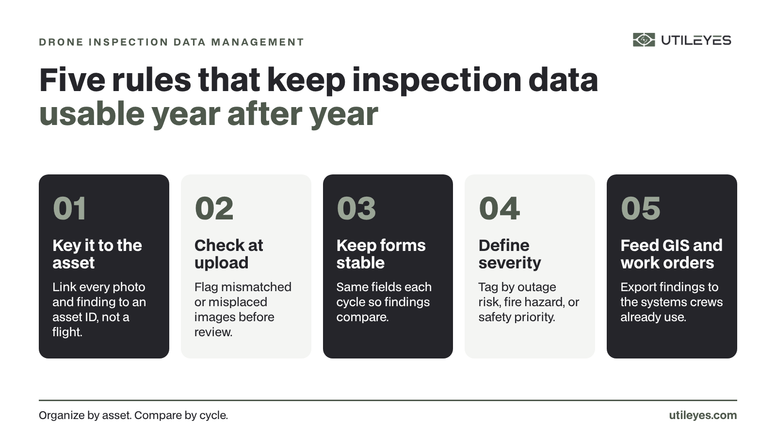
- Rank the criteria against your bottlenecks. Put the most weight on whichever criteria address where you lose the most time today.
- Shortlist two or three platforms that appear strong on your top-ranked criteria.
- Test each with your own field data, running the full workflow from upload to work order.
- Time the photo-to-dispatch cycle for each platform under realistic conditions.
- Confirm integration with your GIS and work order systems before committing.
- Check ease of onboarding by having a team member who was not involved in the demo attempt a full cycle.
Conclusion and Next Steps
The right drone utility inspection software is the one that scores highest on the criteria tied to your biggest operational pain points. Workflow automation, integration, and photo-to-dispatch speed tend to matter most, and they are exactly where Utileyes was engineered to win: same-day auto-organized uploads, native ArcGIS and ESRI integration, and a 15-minute path from photo to dispatch.
To move forward, rank the eight criteria against your own bottlenecks, then put Utileyes to the test with your own field data. Time the full cycle from captured image to dispatch-ready work order, and see how a platform built by utilities, for utilities, holds up against the systems you use today. When you are ready, schedule a demo to see the full workflow in action.
Frequently Asked Questions
What is the most important factor when choosing drone inspection software?
Workflow automation is usually the most important factor, because it removes the manual photo sorting that slows most programs. Utileyes auto-sorts images by asset using GPS metadata so they are ready to inspect the same day, replacing the three to four days many platforms require.
How does Utileyes compare to other drone inspection platforms?
Utileyes was built by utility and drone operations veterans specifically for utilities, while many platforms are adapted from generic drone software. That focus shows in the results: a 15-minute photo-to-dispatch cycle, over 50% lower inspection costs versus outsourcing, and 95% user proficiency in under a day.
Does drone inspection software need to integrate with GIS?
Integration with GIS and work order systems is one of the most valuable capabilities, since inspection data in a silo creates a new bottleneck. Utileyes syncs flight plans with ArcGIS and ESRI and exports clean CSV data straight into work order systems.
How fast can a utility go from drone photo to crew dispatch?
With Utileyes, utilities can move from captured image to dispatch-ready work order in about 15 minutes, depending on inspection complexity. Traditional workflows typically take three to four weeks to reach the same point.
Can a small team run a drone inspection program?
Yes. With automation handling organization, QA, and reporting, a lean team can cover large territories. Utileyes reports 95% user proficiency within a day, which makes it practical for small in-house crews to scale inspections quickly.