Why Utility Companies Are Adopting Drone Inspection Programs
Utility companies across North America are rapidly transitioning from traditional vehicle-based and ground-level inspections to drone-powered programs. The reasons are compelling: drones reduce inspection costs by 30-50%, eliminate the need for bucket trucks in many scenarios, improve inspector safety by keeping personnel out of hazardous situations, and capture higher-quality imagery than ground-based methods.
More importantly, drones enable utilities to inspect more infrastructure in less time. This is a critical advantage as aging grid infrastructure requires more frequent assessment and regulatory requirements around vegetation management and wildfire mitigation continue to intensify.
But starting a drone inspection program isn't as simple as buying a few drones and sending people into the field. Successful programs require careful planning around regulatory compliance, pilot training, equipment selection, software infrastructure, and operational workflows.
This guide walks through the essential steps to launch a utility drone inspection program that delivers real operational value from day one.
Step 1: Define Your Inspection Objectives and Use Cases
Before purchasing equipment or hiring pilots, you need to clearly define what you want your drone program to accomplish.
Common Utility Drone Inspection Use Cases
Routine Pole and Conductor Inspections: Visual assessment of poles, crossarms, insulators, conductors, and hardware for damage, corrosion, or wear. This is the most common starting point for utility drone programs.
Vegetation Management: Identifying trees and vegetation that pose encroachment risks to powerlines, particularly in high fire-threat districts where clearance regulations are strict.
Thermal Inspections: Using thermal imaging cameras to detect hot spots on transformers, connectors, and other equipment that may indicate impending failure.
Storm Damage Assessment: Rapid post-storm surveys to identify damaged infrastructure and prioritize restoration efforts.
Right-of-Way Documentation: Capturing baseline imagery of transmission corridors and distribution circuits for future reference and compliance documentation.
New Construction and Maintenance Verification: Confirming that construction work was completed to specification or documenting pre- and post-maintenance conditions.
Start by selecting one or two high-priority use cases rather than trying to address everything at once. Most utilities begin with routine visual inspections of distribution circuits before expanding into thermal imaging or specialized applications.
Step 2: Understand Regulatory Requirements
Operating drones for commercial utility inspections requires compliance with Federal Aviation Administration (FAA) regulations.
Part 107 Remote Pilot Certification
Any person operating a drone for commercial purposes must hold an FAA Part 107 Remote Pilot Certificate. This requires:
- Being at least 16 years old
- Passing the FAA Aeronautical Knowledge Test (administered at FAA-approved testing centers)
- Passing a TSA security background check
The Part 107 exam covers airspace classifications, weather, flight operations, emergency procedures, and regulations. Many pilots prepare using online study courses, and the exam can typically be passed with 2-3 weeks of study.
Operational Limitations Under Part 107
Part 107 establishes standard operational rules:
- Drones must remain within visual line of sight of the pilot
- Maximum altitude of 400 feet above ground level
- Daytime operations only (unless waiver obtained)
- Cannot fly over people not directly participating in operations (unless drone meets specific safety standards)
- Cannot operate from a moving vehicle
Waivers for Beyond Visual Line of Sight (BVLOS)
Utilities with long linear infrastructure often benefit from Beyond Visual Line of Sight (BVLOS) operations, which allow drones to fly beyond the pilot's direct view. This requires an FAA waiver, which involves demonstrating equivalent safety measures such as visual observers, detect-and-avoid technology, or other mitigation strategies.
BVLOS waivers can take several months to obtain and require detailed operational procedures, so most utilities begin with standard visual line of sight operations and pursue waivers as their program matures.
State and Local Regulations
Some states and municipalities have additional drone regulations, particularly around privacy, flight over critical infrastructure, or operations near certain facilities. Check your state and local regulations to ensure full compliance.
Step 3: Build Your Pilot Team
Your drone program's success depends on having skilled, reliable pilots who understand both aviation operations and utility infrastructure.
Internal vs. Contract Pilots
Internal Pilots: Many utilities train existing employees, such as line technicians, inspectors, or field operations personnel, to become Part 107-certified drone pilots. This approach offers better institutional knowledge, easier scheduling, and long-term cost savings.
Contract Pilots: Some utilities start by contracting with drone service providers to handle flights while internal capabilities are developed. This can accelerate program launch but creates dependency on external resources.
Most utilities eventually build internal pilot capacity, even if they begin with contractors.
Selecting Internal Pilot Candidates
Look for employees who:
- Have strong attention to detail and safety consciousness
- Are comfortable with technology and learning new systems
- Understand utility infrastructure and can recognize potential issues
- Have good hand-eye coordination and spatial awareness
- Are reliable and can work independently in the field
Line technicians and field inspectors often make excellent drone pilots because they already understand what to look for during inspections.
Pilot Training Beyond Part 107
The Part 107 certification covers general aviation knowledge, but utility-specific drone operations require additional training:
- Hands-on flight practice in various weather conditions
- Understanding how to capture inspection-quality imagery
- GPS waypoint mission planning
- Emergency procedures and equipment troubleshooting
- Battery management and field logistics
- Data organization and quality control
Plan for 20-40 hours of supervised flight training before pilots operate independently. Many utilities establish mentorship programs where experienced pilots train newer team members.
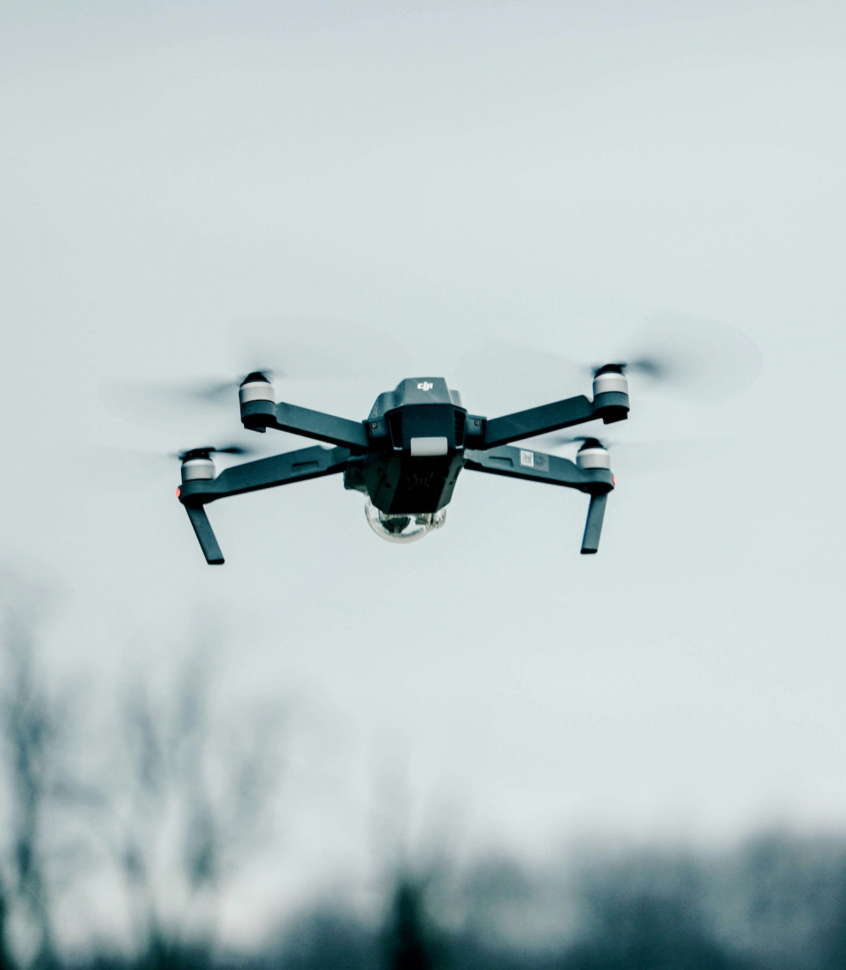
Step 4: Select the Right Drone Equipment

Choosing drone hardware is one of the most visible decisions in program development, but it should be driven by your specific inspection requirements rather than marketing hype.
Key Considerations for Utility Inspection Drones
Camera Quality: For visual inspections, you need high-resolution cameras (20MP or higher) with good optical zoom capabilities. This allows inspectors to examine fine details like insulator damage or conductor wear without requiring the drone to fly dangerously close to energized equipment.
Thermal Imaging: If thermal inspections are part of your program, you'll need drones equipped with radiometric thermal cameras that can capture accurate temperature data, not just visual heat signatures.
Flight Time: Longer battery life means fewer battery swaps and more efficient operations. Look for drones offering 30+ minutes of flight time.
Portability: Field crews need to transport drones between sites throughout the day. Compact, foldable designs are easier to manage than large fixed-wing or industrial drones.
Weather Resistance: Utility inspections don't stop because of light rain or wind. Drones with weather-resistant designs and stable flight characteristics in wind are essential.
Obstacle Avoidance: Since utility drones operate near powerlines, poles, and vegetation, obstacle detection and avoidance systems improve safety and reduce crash risk.
Common Drone Platforms for Utility Inspections
DJI Enterprise Series (Mavic 3 Enterprise, Matrice 30/300 series): These are the most widely used platforms in utility inspections due to their balance of camera quality, flight time, portability, and reliability. The Matrice 30T includes both visual and thermal cameras in one platform.
Parrot Anafi USA: This platform is popular with utilities and government agencies concerned about data security, as it's manufactured in the USA with secure data handling.
Autel EVO Series: Another alternative offering high-quality cameras and good flight performance.
Skydio Drones: Known for advanced obstacle avoidance capabilities, making them well-suited for flying in complex environments near powerlines.
Most utilities standardize on 2-3 drone models to simplify training, maintenance, and spare parts inventory.
Don't Forget Essential Accessories
Beyond drones, your program needs:
- Multiple battery sets (at least 4-6 batteries per drone)
- Charging hubs for efficient battery management
- Portable power stations for field charging
- Hard-shell transport cases
- Tablet or controller with sunshade for outdoor visibility
- Spare propellers, SD cards, and common replacement parts
- Vehicle mounting systems for equipment transport
Step 5: Choose Inspection Management Software
This is where many utility drone programs succeed or fail. Capturing thousands of photos is easy. Organizing, inspecting, and acting on that data is the real challenge.
The Software Problem Most Utilities Face
Traditional approaches to managing drone inspection data involve:
- Manually downloading photos from SD cards
- Creating folder structures to organize images by circuit, pole, or location
- Manually matching photos to asset IDs using GPS coordinates
- Sending organized folders to inspectors
- Receiving inspection reports back via spreadsheets
- Manually entering findings into work order systems
This process can take days or weeks, eliminating much of the speed advantage that drones provide.
What to Look for in Drone Inspection Software
Automatic Photo Organization: The platform should read GPS metadata from images and automatically organize them by asset location without manual folder creation.
Inspection Interface: Inspectors need an intuitive interface for reviewing images, tagging anomalies, and assigning severity levels using customizable inspection forms.
Quality Assurance Tools: Built-in QA that flags mismatched or problematic images saves hours of manual review.
Integration Capabilities: The software should export data to your existing systems, whether that's GIS platforms like ARC GIS or ESRI, work order management tools, or asset databases.
Flight Planning Tools: The ability to create and export flight missions based on asset locations streamlines pilot operations.
Speed from Photo to Action: The entire workflow from photo upload to crew dispatch should take hours, not weeks.
Case Example: Automating Data Management with Utileyes
One utility reduced inspection-to-dispatch time from 2 weeks to under 20 minutes using Utileyes' automated photo organization and inspection interface. The platform eliminated manual folder creation, provided built-in quality assurance, and enabled direct export to their work order system. This allowed the utility to go from captured imagery to crew dispatch the same day, fundamentally changing how they respond to infrastructure issues.
Step 6: Establish Standard Operating Procedures
Formal procedures ensure consistent, safe, and compliant operations across your entire program.
Key SOPs to Develop
Pre-Flight Checklist: Weather assessment, equipment inspection, airspace verification, safety briefing.
Flight Operations: Visual observer protocols, communication procedures, emergency response, proximity guidelines to energized equipment.
Post-Flight Procedures: Battery management, data backup, equipment inspection, flight log documentation.
Data Management: Photo upload procedures, file naming conventions, quality control checks, data retention policies.
Maintenance Schedule: Regular equipment inspections, firmware updates, battery health monitoring, replacement part inventory.
Incident Reporting: Protocols for crashes, near-misses, equipment failures, or safety concerns.
These SOPs should be documented, regularly reviewed, and updated as your program evolves.
Step 7: Launch with a Pilot Program
Rather than immediately deploying drones across your entire service territory, start with a focused pilot program.
Selecting Your Pilot Area
Choose a manageable area such as:
- A single distribution feeder or circuit
- A high-priority zone (fire-threat district, aging infrastructure area)
- A geographically contained region where pilots can easily return to base
This allows you to test workflows, identify issues, and demonstrate value before scaling.
Defining Success Metrics
Establish clear metrics to measure program performance:
- Time savings compared to traditional inspection methods
- Cost per mile or per structure inspected
- Number of critical findings identified
- Time from inspection to crew dispatch
- Inspector and pilot satisfaction
- Data quality and completeness
Iterating Based on Lessons Learned
Expect to refine your processes during the pilot phase. Common adjustments include:
- Flight altitude optimization for best image quality
- Battery management strategies for full-day operations
- Inspection form modifications based on inspector feedback
- Software workflow improvements
- Pilot scheduling and coordination procedures
Document lessons learned and incorporate them into updated SOPs before scaling.
Step 8: Scale Your Program
Once your pilot program demonstrates clear value, you're ready to expand operations.
Growing Your Pilot Team
As you scale, you'll need more pilots. Establish a structured training program where experienced pilots mentor new team members through:
- Ground school covering regulations and procedures
- Simulator practice (if available)
- Supervised field flights
- Progressive responsibility leading to independent operations
Expanding Equipment Inventory
Add drones and accessories based on projected inspection volume. A good rule of thumb: one primary drone per active pilot, plus 20-30% backup inventory for maintenance rotation.
Increasing Inspection Capacity
Scaling also requires sufficient inspector capacity to review captured imagery. Monitor the ratio of flight hours to inspection hours to ensure you're not creating new bottlenecks downstream.
Integrating with Existing Workflows
As your program matures, look for opportunities to integrate drone operations into broader inspection and maintenance workflows:
- Scheduling drone inspections as part of routine maintenance cycles
- Using drone findings to prioritize work orders
- Incorporating drone data into asset management systems
- Training field crews to request drone support for specific situations
Step 9: Maintain and Improve Continuously
Successful drone programs don't remain static. They evolve based on technological advances, regulatory changes, and operational experience.
Regular Program Reviews
Conduct quarterly reviews covering:
- Safety performance and any incidents
- Productivity metrics and cost analysis
- Equipment reliability and maintenance needs
- Software performance and user satisfaction
- Opportunities for process improvement
Staying Current with Technology
Drone technology evolves rapidly. Monitor developments in:
- New camera sensors with better resolution or thermal capabilities
- Battery technology offering longer flight times
- Automated flight and inspection capabilities
- Regulatory changes that may enable new operational approaches
Sharing Best Practices
Many utilities participate in industry groups focused on drone operations, such as the Electric Power Research Institute (EPRI) working groups or regional utility associations. These forums provide valuable opportunities to learn from other programs and share your own experiences.
Common Mistakes to Avoid
Mistake 1: Buying drones before defining use cases. Equipment should match inspection requirements, not the other way around.
Mistake 2: Underestimating data management complexity. The hard part isn't flying drones. It's managing the data they generate.
Mistake 3: Insufficient pilot training. Part 107 certification is just the beginning. Utility-specific training is essential.
Mistake 4: No clear success metrics. Without defined metrics, it's impossible to demonstrate program value or identify improvement opportunities.
Mistake 5: Trying to scale too quickly. Start focused, prove value, then expand methodically.
Start Smart, Scale Strategically
Launching a utility drone inspection program requires careful planning, but the operational benefits are substantial. Utilities with mature programs report significant cost savings, improved safety outcomes, faster response to critical issues, and better overall visibility into infrastructure condition.
The key is starting with clear objectives, building the right team and capabilities, choosing appropriate technology (especially inspection management software), and scaling based on demonstrated results.
Ready to Launch Your Drone Inspection Program?
Utileyes Inspections provides the software foundation that makes utility drone programs successful. Our platform eliminates the data management bottleneck that prevents many programs from reaching their full potential.
See how Utileyes can support your drone inspection program from day one.
Have questions about program development, software implementation, or best practices? We're here to help.
At Utileyes, we're committed to helping utilities build drone inspection programs that deliver real operational value. Let us show you how the right software makes all the difference.