Type "best utility pole inspection software" into a search bar and you will get a wall of feature lists, most of them interchangeable. The trouble is that half those features never touch the work that slows a real program down. A utility inspecting tens of thousands of poles does not need more checkboxes.
It needs the specific capabilities that shrink the time, cost, and risk of getting a defect from a photo to a repair crew. Below are the eight features that earn their keep, why each one matters on the ground, and how Utileyes delivers them.
Quick Summary
- The features that separate the best utility pole inspection software are the ones that remove manual work between capture and repair.
- Automatic GPS-based image sorting is the highest-impact feature, eliminating the three to four days pilots often spend filing photos.
- Built-in quality assurance prevents re-flights by catching upload errors instantly.
- Severity tagging by outage, safety, and fire risk turns findings into prioritized dispatch decisions.
- Native ArcGIS, ESRI, and work order integration keeps pole data flowing instead of stranded in a silo.
- Photo-to-dispatch speed is the truest benchmark, and Utileyes hits roughly 15 minutes against a three-to-four-week manual baseline.
- Ease of use drives adoption, with Utileyes reporting 95% of users proficient in under a day.
What Actually Slows a Pole Inspection Program Down
Before judging features, it helps to know where utility pole programs bleed time and money. The flying is rarely the issue. One pilot can document a hundred poles in a day.
The drag comes afterward. Thousands of pole images have to be matched to the correct structures, reviewed for defects, scored, written into a report, and pushed into a work order system. On many platforms the file-matching step alone consumes three to four days, and every later handoff adds more. By the time a crew gets the assignment, weeks have passed.
So the features worth paying for are the ones that attack that post-flight pileup. The seven that follow do exactly that, plus the one feature that determines whether any of it gets used.
Feature 1: Automatic GPS-Based Image Sorting
This is the feature that matters most, because it eliminates the single largest delay in the workflow.
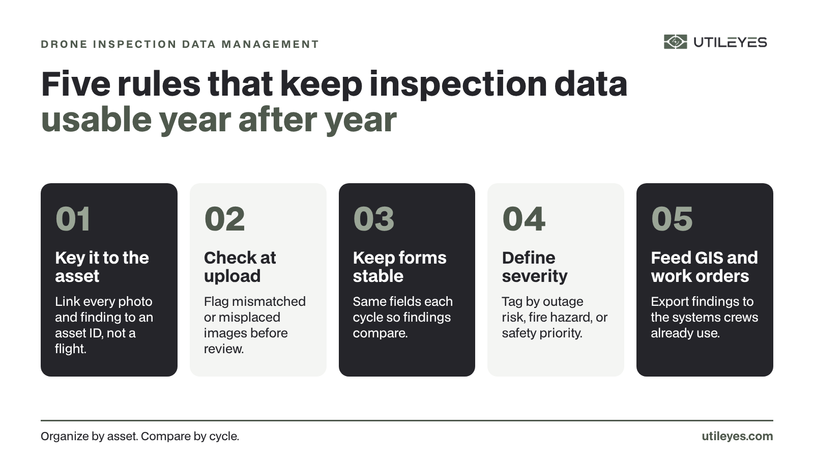
On platforms without it, a pilot spends three to four days after each flight manually matching images to poles. Utileyes does it on upload. GPS metadata pins each photo to its mapped asset and the system sorts the entire set automatically, leaving the images inspection-ready the same day. The company credits this with an 85% reduction in manual processing time and a 95% drop in organization errors. For a high-volume pole program, that one capability resets the whole timeline.
Feature 2: Built-In Quality Assurance
Bad data caught late is expensive, because it usually means sending a pilot back out. The best software validates as it goes.
Utileyes checks each uploaded image against its mapped asset, flags any mismatch the moment it appears, and recommends a one-click reassignment. No one discovers a misfiled pole photo three weeks later, and no one re-flies a route to recapture data that was simply filed wrong. For pole inspections spread across difficult terrain, avoiding a single re-flight can pay for a lot of software.
Feature 3: Severity Tagging That Fits Your Standards
A pole inspection that flags a problem but cannot rank it leaves crews guessing. Effective software lets inspectors classify findings by the risks the utility actually manages.
Utileyes supports severity tagging during both image review and thermal scans, with categories for outage risk, safety hazard, and fire mitigation. Crews are dispatched according to those ratings, so a cracked crossarm on a high-fire-threat circuit gets attention ahead of cosmetic wear elsewhere. Tagging also keeps scoring consistent across inspectors instead of varying by who happened to review the pole.
Feature 4: Native GIS and Work Order Integration
Pole data that cannot move is pole data that stalls. Integration is what carries a finding from the inspection screen to a lineman's assignment.
Utileyes syncs flight plans with GIS data from ArcGIS and ESRI and exports clean CSV files that load directly into work order systems. The result is an unbroken path from a captured pole image to a dispatched crew, with no one retyping data between tools. That continuity is what lets utilities keep their existing systems while still gaining speed.
Feature 5: Same-Day, Repeatable Speed From Photo to Dispatch
Speed is the feature that ties the others together, and it is the cleanest way to compare platforms.
A traditional pole inspection workflow runs three to four weeks from flight to actionable work orders. Utileyes brings that down to about 15 minutes, depending on complexity, roughly 90% faster. Because the upstream steps are automated rather than improvised, that speed repeats inspection after inspection. For storm response and fire season, the ability to turn a morning flight into an afternoon repair changes what a utility can prevent.
Feature 6: Flexible Flight Assignment and Mapping
Getting pilots to the right poles efficiently sets the tone for everything downstream. Mapping and assignment should take seconds, not a morning of spreadsheet wrangling.
Utileyes lets teams upload existing GIS data or auto-generate asset points, then overlay poles onto a 3D topographic map. A visual lasso tool assigns spans of poles to pilots in seconds, and preloaded flight plans put the route and assignments on one screen. Clear assignments mean full coverage and fewer missed structures, which keeps the inspection record complete.
Feature 7: Customizable Inspection Forms
No two utilities inspect a pole exactly alike, so rigid forms force teams to either skip relevant data or capture it off-system. The software should bend to your standards.
Utileyes starts inspectors with industry-proven templates, then lets them add or edit fields to match utility standards and adjust in real time during an inspection. That flexibility means the data captured reflects how your crews actually evaluate a pole, which makes the resulting reports more useful to engineering and compliance.
Feature 8: Ease of Use That Drives Adoption
The most capable software is worthless if field teams quietly stop using it. Adoption is a feature, even if it rarely appears on a comparison chart.
Many pole inspection platforms are overbuilt and hard to learn, which sends crews back to old habits. Utileyes was built to be simple, fast, flexible, and affordable, and the adoption data reflects it: the company reports 95% of users reaching proficiency in under a day. That low learning curve is what makes a small in-house team able to run a serious pole program without a dedicated software specialist.
A Quick Way to Rank These Features for Your Utility
Not every feature carries equal weight for every team. Use this short process to prioritize.
- Find your biggest delay. If photos pile up unsorted, weight automatic GPS sorting and QA highest.
- Check your systems. If you run ArcGIS, ESRI, or a specific work order platform, make integration a hard requirement.
- Weigh your risk profile. If wildfire exposure is high, push severity tagging and thermal review up the list.
- Account for your team size. A lean crew should treat ease of use and automation as non-negotiable.
- Test photo-to-dispatch speed. Whatever you prioritize, time the full cycle on your own data before deciding.
Choosing With Confidence
The best utility pole inspection software is not the one with the longest feature list. It is the one that strips the most manual work out of the path between a captured pole image and a dispatched crew. Automatic image sorting, built-in QA, severity tagging, and native GIS integration do the heavy lifting, photo-to-dispatch speed proves the result, and ease of use ensures the whole thing actually gets used.
Utileyes was built around those eight features by a team that spent years watching utility pole programs lose days to manual sorting and disconnected tools. The same-day uploads, ArcGIS and ESRI integration, severity-driven dispatch, and 15-minute turnaround all trace back to that experience.
The surest test is to hold any platform up to these eight features and then run your own poles through it. Schedule a demo, bring a real circuit, and measure how fast a pole photo becomes a work order your crew can act on. Contact us today, info@utileyes.com.
Frequently Asked Questions
What is the most important feature in utility pole inspection software?
Automatic GPS-based image sorting tends to matter most, because it removes the largest delay in the workflow. Utileyes matches each photo to its pole on upload and organizes the set the same day, replacing the three to four days manual filing usually takes.
What makes one pole inspection platform better than another?
The difference is how much manual work the platform removes between capturing a pole image and dispatching a crew. The strongest options combine automatic sorting, built-in QA, severity tagging, and direct GIS and work order integration, which together collapse a multi-week process into minutes.
Does utility pole inspection software work with ArcGIS and ESRI?
It should, since integration keeps pole data from getting stranded. Utileyes syncs flight plans with ArcGIS and ESRI and exports clean CSV data into work order systems, so findings move straight to crews.
How does severity tagging help with pole inspections?
It lets inspectors rank each finding by outage risk, safety hazard, or fire mitigation, so crews address the most dangerous poles first. Utileyes applies severity tagging during both image and thermal review, keeping prioritization consistent across the team.
Is pole inspection software difficult for crews to learn?
A well-designed platform should not be. Overbuilt tools lose users, while focused ones get adopted. Utileyes reports 95% of users proficient within a day, which is what makes it workable for small in-house pole inspection teams.