Quick Summary
- Municipal utility drone inspections let a small city-owned line crew inspect poles, spans, and streetlights without hiring a separate aviation department. Utileyes is drone inspection software for utilities built for that kind of lean team.
- Public power utilities serve nearly 55 million people in about 2,000 communities, and many of them run lean crews that wear several hats.
- Government entities can fly under FAA Part 107 or as public aircraft with a Certificate of Waiver or Authorization (COA).
- The win for a municipal utility is not the drone. It is turning photos into prioritized, documented work that a council and the public can follow.

Municipal utility drone inspections work best when a small crew follows a simple, repeatable loop: map the assets, fly by circuit, tag what matters, and report it in plain terms. The drone captures the images, but the workflow behind it decides whether a city-owned utility actually gets faster repairs.
Utileyes is drone inspection software for utilities, built by people who flew utility inspections. This guide is written for municipal utility superintendents, line crews, and public works leaders who want drone inspections to fit a small team instead of creating a new department.
The angle here is the size of the team. Most drone program advice assumes a large utility with dedicated pilots and analysts. Municipal utilities usually have neither, so the process has to be lighter.
What are municipal utility drone inspections?
Municipal utility drone inspections are visual and thermal inspections of a city-owned utility's poles, lines, and related equipment, captured by drone and reviewed in software. A city's own line crew or a contracted pilot flies the assets. The images are then tied to each asset, reviewed for defects, and turned into repair work.
A municipal utility is an electric utility owned by a local government, such as a city or town. These utilities are part of what the industry calls public power. They answer to a city council or utility board instead of shareholders.
That ownership model shapes how inspections should run. Every dollar is public, every outage is local news, and results often go in front of elected officials. Drone inspections help because they put a documented photo record behind each decision.
Why do municipal utilities need a different inspection approach?
Municipal utilities need a lighter inspection approach because they serve whole communities with small, multi-role crews. The same linemen who restore outages also build services and maintain streetlights. A drone workflow has to fit between those jobs, produce clear records for public oversight, and avoid adding headcount or a separate aviation team.
The scale of public power is larger than many people expect. According to the American Public Power Association 2026 fact sheet, public power serves nearly 55 million people in approximately 2,000 communities across 49 states and five territories. The same fact sheet groups these utilities by size, starting at fewer than 2,000 customers.
In practice, that means three constraints show up again and again:
- Small crews. There is rarely a full-time drone pilot or a dedicated inspection analyst.
- Public accountability. Spending decisions and reliability results are reported to a council or board.
- Mixed asset types. Distribution poles, overhead lines, and city streetlights often sit in the same work queue.
Can a municipal utility fly drones under Part 107 or a public COA?
Yes. The FAA gives government entities two paths for drones under 55 pounds. A municipal utility can fly under 14 CFR Part 107, the small UAS rule, or operate as a public aircraft with a Certificate of Waiver or Authorization (COA) that lets the entity self-certify its aircraft and operators for governmental functions.
The FAA's guide for government drone programs describes both options. Part 107 covers visual line-of-sight flights at or below 400 feet above ground level. The public aircraft path relies on federal statute and a COA.
Which path fits depends on the city's legal review, insurance, and how the utility is organized. Many utility teams start with Part 107 because the rules and pilot training are well documented. For the basics, see our post on FAA Part 107 for utility teams.
The American Public Power Association's issue brief on drone use lists storm damage assessment, distribution and transmission surveys, and construction support among the ways public power utilities use drones.
How can a small crew run drone inspections without a dedicated team?
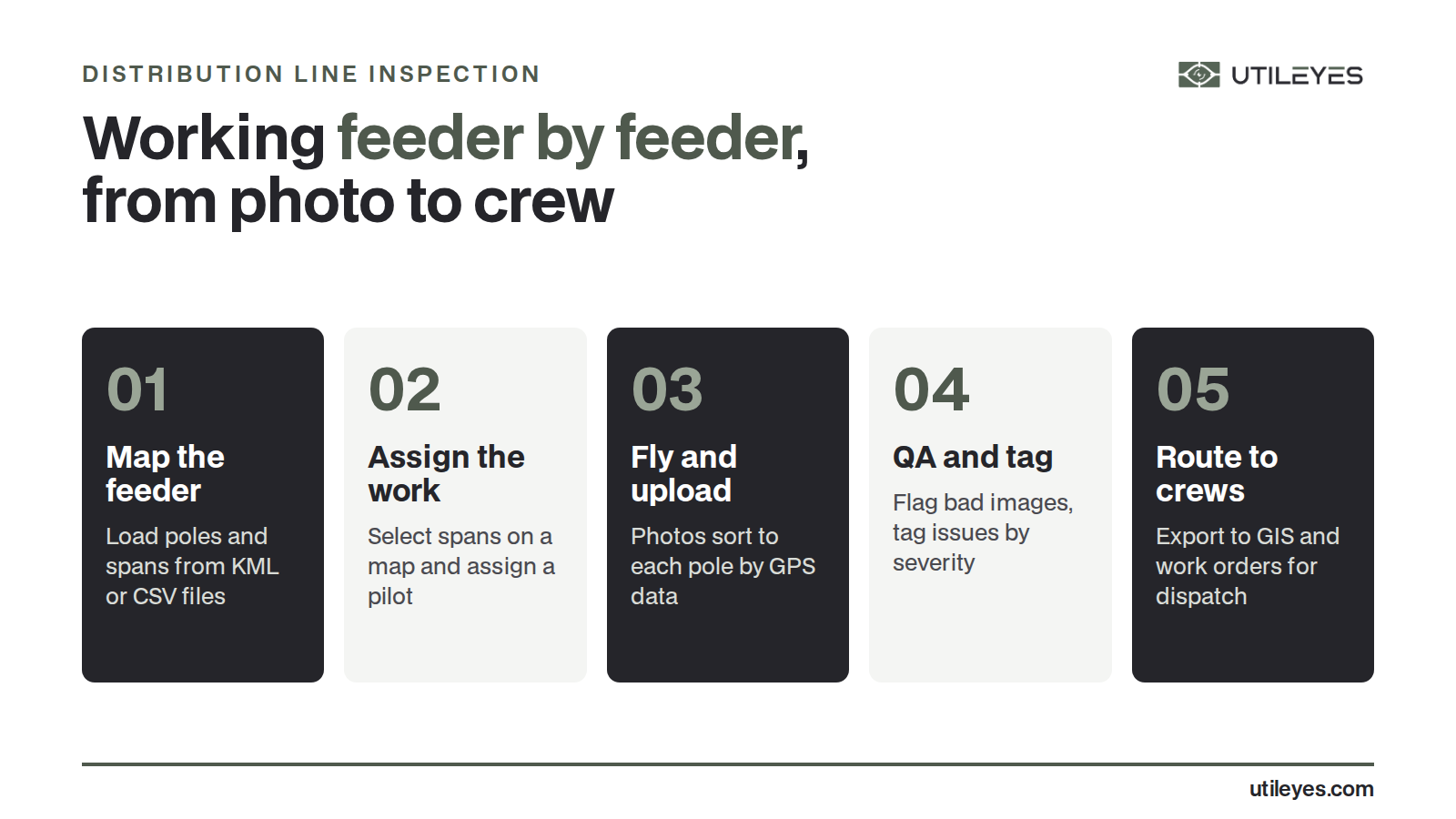
A small crew can run drone inspections by keeping every step inside one workflow: load the asset map once, assign flights by area, upload photos that sort themselves by asset, and review only what gets flagged. Software handles the filing and checking, so linemen spend their time on judgment calls and repairs.
1. Map the assets once
Start with the pole and asset data the city already has. Utileyes builds a smart asset map from KML or CSV files, or from asset points generated in flight. If GIS records are incomplete, the first flights help fill the gaps.
2. Fly by circuit, not by calendar
Assign work in chunks a crew can finish between other jobs. In Utileyes, a supervisor uses a lasso tool on the map to assign poles or spans to a pilot. Preloaded flight plans stay synced with GIS data.
3. Let the upload do the sorting
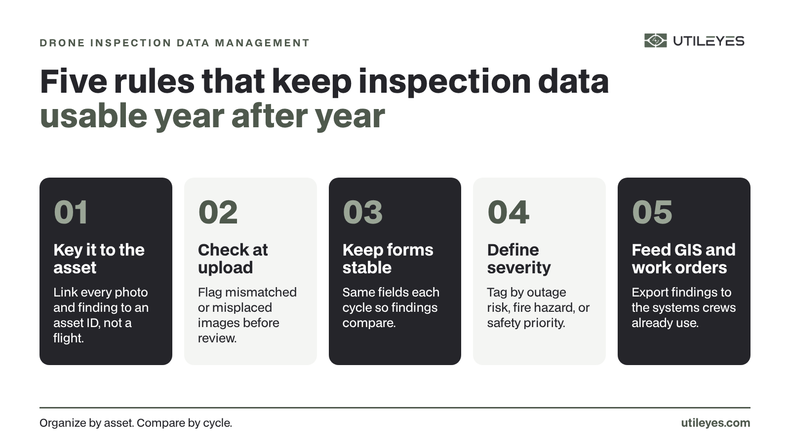
Photo sorting is where small teams lose the most time. Utileyes organizes drag-and-drop uploads by asset using GPS metadata. Built-in QA flags mismatched or misplaced images during upload, so a missing shot is caught before the crew leaves the area.
4. Tag severity to the city's own standards
Reviewers tag each finding by outage risk, fire hazard, or safety priority. The severity scale follows each utility's standards, not a generic template. Side-by-side RGB and thermal review helps confirm a suspect connection.
Which assets should a municipal utility inspect first?
A municipal utility should usually inspect first where failure would hurt the most people: feeders serving critical facilities, older pole lines, and circuits with repeat outages. Hard-to-reach spans behind homes or across rough ground are also strong early candidates, because a drone reaches them faster than a truck or a climb.
Streetlights are a common addition for city-owned utilities. They share poles and crews with the distribution system, so it often makes sense to capture them on the same flights and track them in the same map.
| Asset group | Why start here | What to capture |
|---|---|---|
| Feeders to critical facilities | Outages affect the most people and services | Top-of-pole photos, crossarms, insulators, connections |
| Older pole lines | Highest likelihood of wear and damage | Pole tops, hardware, signs of rot or lean |
| Repeat-outage circuits | Known trouble spots need a root cause | RGB and thermal images of suspect components |
| Backlot and hard-access spans | Slow and costly to reach on foot or by truck | Full span views and attachment points |
| Streetlights on shared poles | Same poles, same crews, one trip | Fixture condition and mounting hardware |
How should municipal utilities report drone inspection results?
Municipal utilities should report drone inspection results in terms a council or board can follow: how much of the system was covered, what was found, how serious it is, and what has been fixed. A dashboard view plus an exportable record of each finding gives leaders clear answers without pulling linemen off the job.
Utileyes executive dashboards show coverage, anomalies, and efficiency in one place. Findings export as CSV files compatible with ArcGIS and ESRI, and the platform integrates with existing GIS and work order systems instead of replacing them.
That record matters at budget time. A photo of a cracked crossarm, tagged by severity and linked to a work order, explains a capital request better than a spreadsheet line ever will.
A field-tested example
Utileyes was built in the field, not in a conference room. The founders personally flew more than 10,000 utility inspections, and the leadership team brings more than 50 years of combined utility operations experience. The platform was built with utility linemen and drone pilots.
For a small municipal crew, two outcomes matter most. Utileyes can take a finding from photo captured to crew dispatched in as little as 15 minutes. Utilities that bring inspections in-house with Utileyes see about 50% lower inspection cost than outsourcing to vendors.
For a municipal utility with no drones yet, Utileyes works with partners on hardware recommendations and Part 107 training resources. Read more about how Utileyes works or compare models in outsourced DSP vs. in-house drone programs.
FAQ
Do municipal utilities need a full-time drone pilot?
No. Many municipal utilities train existing linemen or field staff to fly. The key is a workflow that fits between other jobs, with software that sorts photos and checks quality automatically.
How many people do public power utilities serve?
The American Public Power Association reports that public power serves nearly 55 million people in approximately 2,000 communities. Utilities range from fewer than 2,000 customers to more than 100,000.
Can a city utility fly drones without Part 107?
A government entity can operate as a public aircraft with an FAA Certificate of Waiver or Authorization (COA) for governmental functions. The FAA also allows government entities to fly under Part 107. City legal and risk teams should review which path fits.
Can drone inspections include streetlights?
Yes. Streetlights on shared poles can be captured on the same flights as distribution assets. Tracking them in the same asset map keeps one record per pole.
Will drone inspection software replace our GIS or work order system?
Utileyes integrates with existing GIS and work order systems rather than replacing them. Findings also export as ArcGIS and ESRI-compatible CSV files.
Start with one circuit
Municipal utility drone inspections do not need a big program to pay off. Start with one circuit, prove the workflow with your own crew, and build from there. See how Utileyes fits a public power team on our solutions page.
Schedule a demo to see the photo-to-dispatch workflow on your own assets.