Quick Summary
- Storm damage assessment software turns patrol findings into a damage count: what broke, where, how bad, and what it takes to fix. Utileyes, drone inspection software for utilities, ties each finding to a pole or span.
- Good assessment starts with a patrol plan by circuit, a standard damage form, and photos tied to each pole or span.
- Drones and foot patrols do different jobs after a storm. Most utilities need both.
- Severity tags turn a long list of damage into a restoration order crews can work from.

Storm damage assessment software helps utilities record what a storm broke, pole by pole and span by span, and turn those findings into a restoration plan. The goal is a damage count that dispatchers, crews, and material yards can trust before the first repair truck rolls.
Utileyes is drone inspection software for utilities, built by people who flew utility inspections. This post covers how damage assessment works after a storm, what your form should capture, when drones beat foot patrols, and how a damage count becomes a work plan.
Weather is the main driver of large outages. Climate Central found that 80% of major U.S. power outages reported from 2000 to 2023 were due to weather-related events, based on Department of Energy data (Climate Central, 2024).
What is storm damage assessment software?
Storm damage assessment software is a tool that collects field findings after a storm, ties each finding to a specific asset, and rolls them into a single count of damage by circuit or area. It replaces paper sheets and phone calls with one record that restoration planners, dispatchers, and crews all read from.
Damage assessment is the step between "the storm passed" and "crews are fixing things." An assessor, the person who patrols a circuit and logs damage, walks, drives, or flies the line and records what they find.
The software matters because assessment is where restoration time is won or lost. TD World described damage assessment as "a choke point in power restoration" in its coverage of early EPRI drone testing (TD World).
How do you inspect power lines after a storm?
Inspect power lines after a storm in a fixed order: make the area safe, assign patrols by circuit, capture photos tied to each asset, tag every finding by severity, then build the damage count. Skipping the plan or the tagging step is what leaves dispatchers guessing.
- Make it safe. Treat every downed conductor as energized until it is confirmed otherwise. Keep assessors out of areas crews have not cleared.
- Assign patrols by circuit. Split the system into patrol areas so no span gets missed and no span gets patrolled twice.
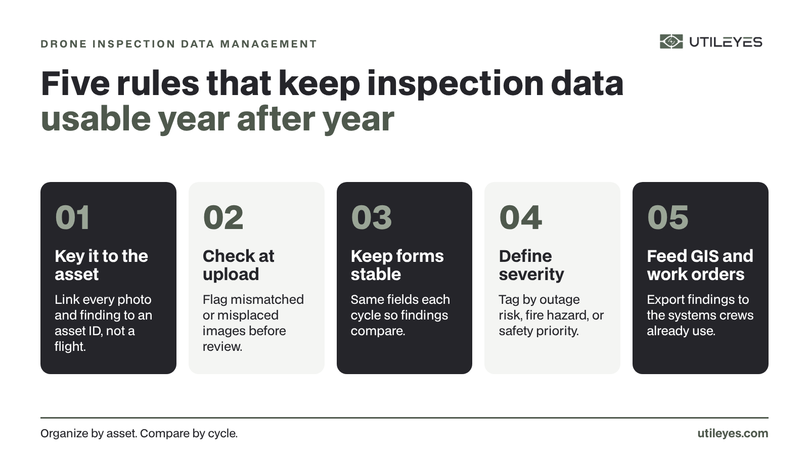
- Capture by asset. Every photo should land on a pole ID or span, not in a camera roll.
- Tag severity. Mark each finding by outage risk, public safety, or fire hazard.
- Build the count. Roll findings up by circuit so planners can size crews and pull materials.
In Utileyes, the patrol plan is built on a map. A supervisor can use a lasso tool to assign poles and spans to each pilot, so coverage is clear before anyone leaves the yard. You can see the full flow on the How It Works page.
What should a storm damage assessment form capture?
A storm damage assessment form should capture the asset ID, the damage type, the severity, a photo, and what the repair will need. Keep it short. Assessors in storm conditions fill out forms fast, and every extra field is one more thing left blank.
Standard damage types make the count add up. If one assessor writes "pole down" and another writes "broken pole," the totals split. A dropdown fixes that.
| Damage type | What to record | Why it matters for restoration |
|---|---|---|
| Broken or leaning pole | Pole ID, break location, pole class if known | Drives pole and digger truck counts |
| Wire down | Span, phase, whether it is in a road or yard | Public safety priority and conductor needs |
| Tree or limb on line | Span, size of tree, whether the line is still up | Tells you if a tree crew must go first |
| Crossarm or insulator damage | Pole ID, which component, photo angle | Material list for hardware |
| Transformer or equipment damage | Pole ID, equipment type, visible leaks or burn marks | Specialty equipment and handling needs |
| Access problem | Road closed, flooding, gated access | Sets the order crews can reach work |
Utileyes uses customizable inspection forms, so your storm form can match the damage codes your restoration team already uses. If you run separate forms for routine and storm work, keep the damage types consistent across both.
Drone vs foot patrol: which works better after a storm?
Drones work better where roads are blocked, spans cross fields or water, or you need a close look at hardware at the top of the pole. Foot and vehicle patrols work better for quick checks along roads and for confirming what drone photos show. Most storm plans use both.
Ground patrols have long been the default. A 2016 TD World report noted that ground crews traditionally drove circuits at roughly 5 to 10 mph and entered findings into handheld devices, often in hazardous conditions (TD World).
| Factor | Drone patrol | Foot or vehicle patrol |
|---|---|---|
| Blocked roads or flooding | Can reach spans the truck cannot | Stopped until access is cleared |
| Top-of-pole hardware | Close view of crossarms, insulators, and connections | Limited to what binoculars show from the ground |
| Off-road spans | Covers fields, ravines, and water crossings | Slow, and sometimes unsafe after a storm |
| Weather limits | Grounded by high wind, heavy rain, or low visibility | Can work in conditions that ground a drone |
| Record quality | Photos tied to GPS location for every finding | Depends on the assessor's notes and phone photos |
One thing to plan for: flying in a disaster area can bring airspace restrictions. The FAA lists "Utility or Other Critical Infrastructure Restoration" as an eligible use for its expedited Special Governmental Interest process (FAA). Sort out who files those requests before storm season. For pilot rules, see our post on FAA Part 107 for utility teams.
How does a damage count become a restoration plan?
A damage count becomes a restoration plan when every finding has a severity tag and a location. Planners sort by severity, group the work by circuit and access, and turn each group into crew assignments and a material list. Without tags, the count is just a long list.
Tag severity the same way every time
Severity tagging means labeling each finding by how urgent it is. Utileyes lets each utility tag findings by outage risk, fire hazard, or safety priority, using its own standards. A wire down in a schoolyard and a cracked insulator on a rural lateral should never look the same on the list.
Group the work so crews are not crisscrossing
Once findings are tagged, group them by circuit and by what equipment they need. A pole replacement needs a different truck than a tree on a line. Grouping keeps one crew from driving past three jobs it could have fixed.
Send it where crews already work
The plan only helps if it reaches the people doing the work. Utileyes integrates with existing GIS and work order systems rather than replacing them, and it exports CSV files that are compatible with ArcGIS/ESRI. Executive dashboards show coverage and anomalies, so managers can see which circuits are still unassessed.
What this looks like with Utileyes in storm work
Utileyes was built with utility linemen and drone pilots. The founders personally flew more than 10,000 utility inspections, and the leadership team has 50+ years of combined utility operations experience. That field time shaped how the platform handles a storm day.
Here is the flow. A pilot finishes a patrol and drags the photos into Utileyes. The photos are auto-organized by GPS location and asset ID. Built-in QA flags any image that does not match the expected asset, so a mislabeled pole gets caught during upload, not during repair.
The reviewer opens each asset, checks RGB and thermal images side by side where both exist, and tags the damage. Going from photo captured to crew dispatched can take as little as 15 minutes. For a closer look at that handoff, read how to move from photo to dispatch in minutes.
The same tools serve routine work between storms. That matters because crews who use the software every week do not have to learn it under storm pressure. See how different teams use it on the Solutions page.
Frequently Asked Questions
What does a utility damage assessor do?
A damage assessor patrols an assigned circuit after a storm and records every piece of damage they find. They log the location, damage type, and severity, usually with photos. Their findings set crew sizes, material orders, and restoration order.
Can drones fly over a disaster area to assess power line damage?
Yes, but airspace restrictions may apply. The FAA's Special Governmental Interest process lists utility and critical infrastructure restoration as an eligible use. Pilots still need to follow Part 107 or their approved authorization.
Should storm damage assessment use the same software as routine inspections?
Using one platform for both is usually easier on crews. They already know the forms, upload steps, and map. Utileyes supports customizable forms, so storm damage codes can sit next to routine inspection forms.
How do you prioritize repairs after a storm?
Start with public safety hazards like wires down near roads and homes. Then work in order of outage impact, so repairs that restore the most customers go first. Severity tags in the assessment record make that sort fast.
Does storm damage assessment software replace GIS or work order systems?
It should not. Utileyes integrates with GIS and work order systems and exports ArcGIS/ESRI-compatible CSV files. Assessment data feeds the systems your dispatchers already use.
Get Your Storm Assessment Ready Before the Next Storm
The best time to fix your damage assessment process is on a calm day. Set up your patrol areas, your storm form, and your severity tags now, so the next storm runs on a plan instead of phone calls.
Schedule a demo to see how Utileyes handles storm damage assessment from patrol to dispatch.